MyTopo
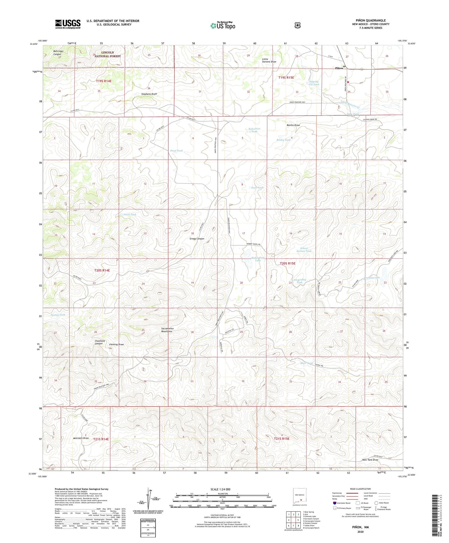
Pinon New Mexico US Topo Map
Couldn't load pickup availability
Also explore the Pinon Forest Service Topo of this same quad for updated USFS data
2023 topographic map quadrangle Pinon in the state of New Mexico. Scale: 1:24000. Based on the newly updated USGS 7.5' US Topo map series, this map is in the following counties: Otero. The map contains contour data, water features, and other items you are used to seeing on USGS maps, but also has updated roads and other features. This is the next generation of topographic maps. Printed on high-quality waterproof paper with UV fade-resistant inks.
Quads adjacent to this one:
West: Surveyors Canyon
Northwest: Bear Spring
North: Avis
Northeast: Chimney Lake
East: Cornucopia Canyon
Southeast: Cornucopia Ranch
South: Indian Draw
Southwest: Sixteen Canyon
This map covers the same area as the classic USGS quad with code o32105e4.
Contains the following named places: Behringer Canyon, Blair Tank, Bonita Draw, Coupland Ranch, Danley Tank, Dare Tank, Dean Tank, Dipping Vat Tank, Finch Tank, First Baptist Church, Gregg Canyon, Havens Ranch, Jim Godley Tank, Pinon, Pinon Census Designated Place, Pinon Post Office, Pinon Volunteer Fire Department, Resley Tank, Richardson Lake, Robertson Tank, School Section Tank, Scott Tank, Shockley Lake, South Prong Stevens Creek, Sowell Ranch