MyTopo
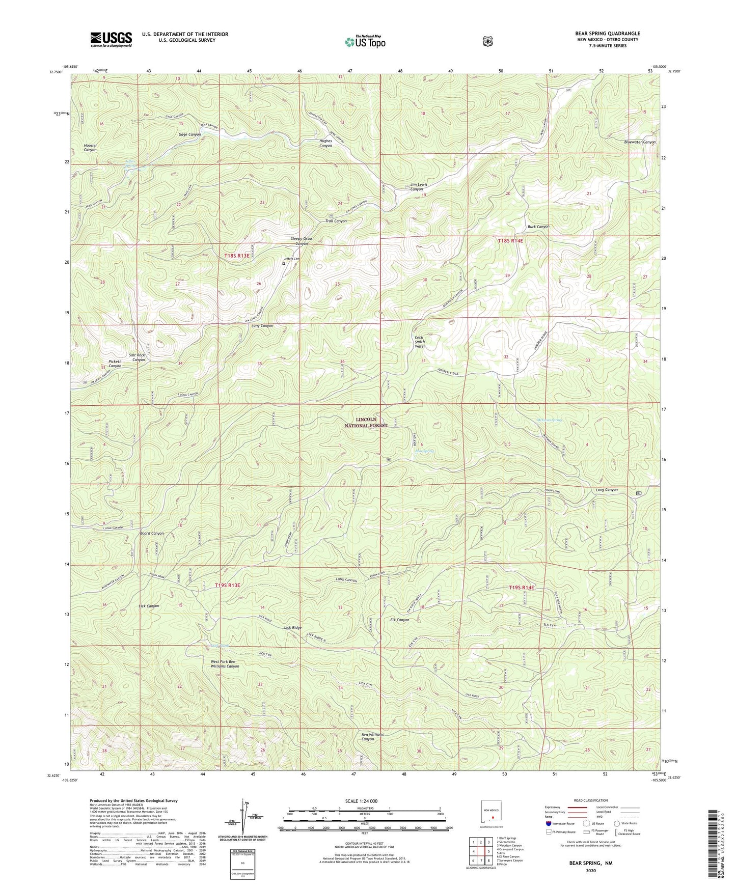
Bear Spring New Mexico US Topo Map
Couldn't load pickup availability
Also explore the Bear Spring Forest Service Topo of this same quad for updated USFS data
2023 topographic map quadrangle Bear Spring in the state of New Mexico. Scale: 1:24000. Based on the newly updated USGS 7.5' US Topo map series, this map is in the following counties: Otero. The map contains contour data, water features, and other items you are used to seeing on USGS maps, but also has updated roads and other features. This is the next generation of topographic maps. Printed on high-quality waterproof paper with UV fade-resistant inks.
Quads adjacent to this one:
West: Graveyard Canyon
Northwest: Bluff Springs
North: Sacramento
Northeast: Woodson Canyon
East: Avis
Southeast: Pinon
South: Surveyors Canyon
Southwest: El Paso Canyon
This map covers the same area as the classic USGS quad with code o32105f5.
Contains the following named places: Bear Spring, Board Canyon, Buck Canyon, Carrisa Lookout Complex Historic Site, Carrisa Lookout Tower, Cecil Smith Water, Gage Canyon, Hughes Canyon, Jeffers Cemetery, Jeffers Spring, Jim Lewis Canyon, Lick Ridge, Lick Tank, Lick Trick Tank, Long Canyon, McEwan Spring, Pickett Canyon, Salt Rock Canyon, Sleepy Grass Canyon, Trail Canyon, Upper Long Tank, Welch Lodge