MyTopo
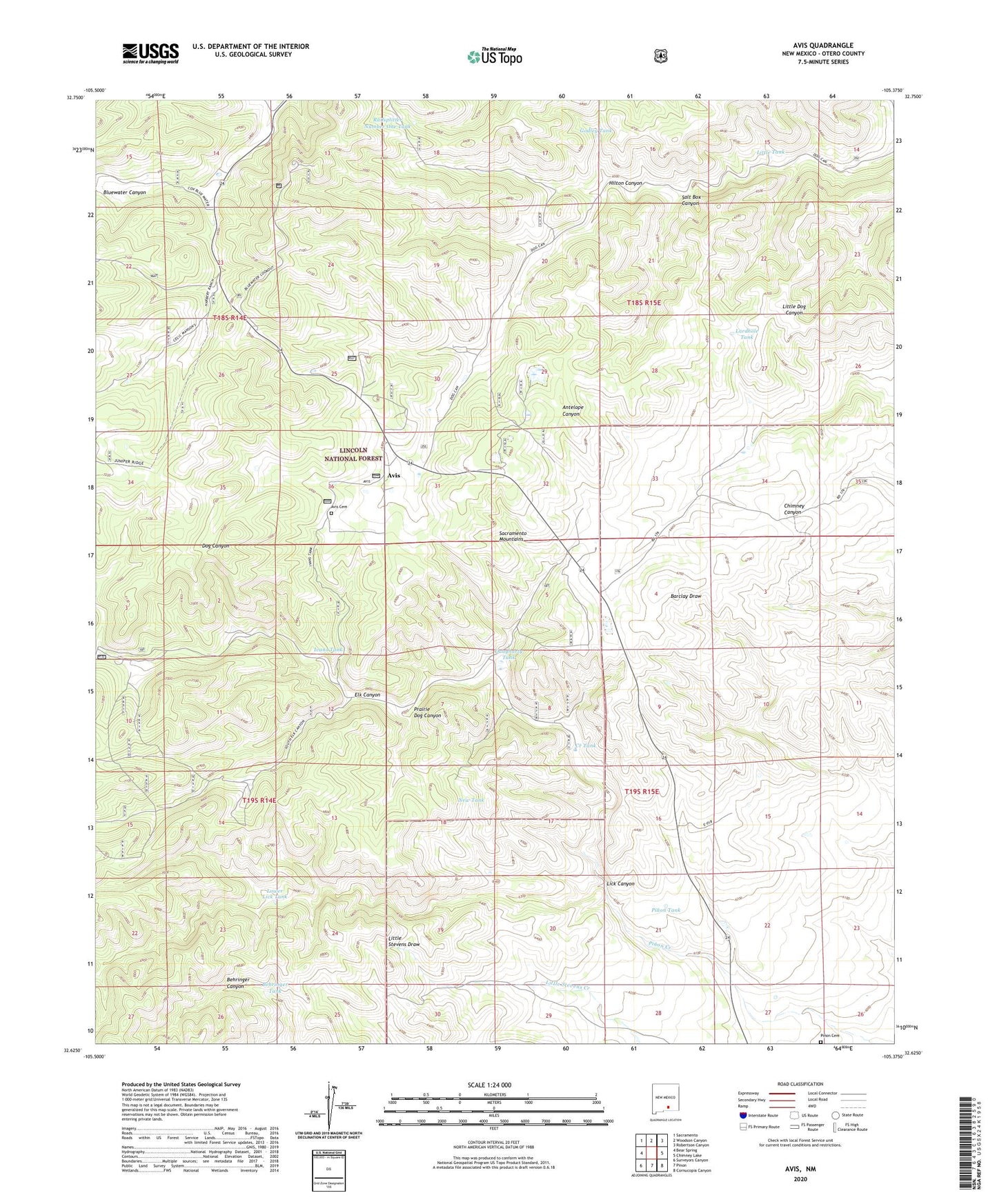
Avis New Mexico US Topo Map
Couldn't load pickup availability
Also explore the Avis Forest Service Topo of this same quad for updated USFS data
2023 topographic map quadrangle Avis in the state of New Mexico. Scale: 1:24000. Based on the newly updated USGS 7.5' US Topo map series, this map is in the following counties: Otero. The map contains contour data, water features, and other items you are used to seeing on USGS maps, but also has updated roads and other features. This is the next generation of topographic maps. Printed on high-quality waterproof paper with UV fade-resistant inks.
Quads adjacent to this one:
West: Bear Spring
Northwest: Sacramento
North: Woodson Canyon
Northeast: Robertson Canyon
East: Chimney Lake
Southeast: Cornucopia Canyon
South: Pinon
Southwest: Surveyors Canyon
This map covers the same area as the classic USGS quad with code o32105f4.
Contains the following named places: Avis, Avis Cemetery, Avis Post Office, Behringer Tank, Bell Ranch, Bluewater Lookout Tower, Brooks Well, Creek Tank, Daugharty Tank, Elk Canyon, Godley Tank, Hilton Canyon, Ivans Tank, Lardhole Tank, Lick Canyon, Little Tank, Lower Lick Tank, New Tank, Pinon Cemetery, Pinon Tank, Prairie Dog Canyon, Railsplitter Number One Tank, Salt Box Canyon