MyTopo
Ponderosa New Mexico US Topo Map
Couldn't load pickup availability
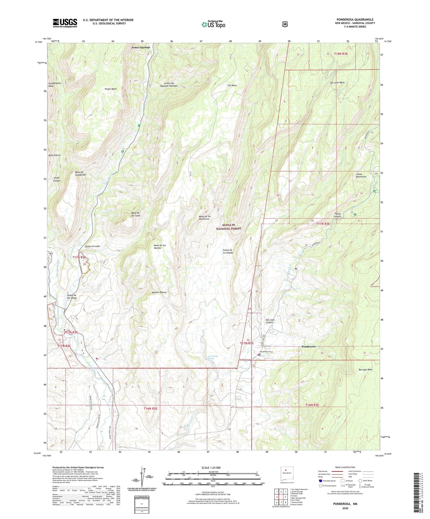
2020 topographic map quadrangle Ponderosa in the state of New Mexico. Scale: 1:24000. Based on the newly updated USGS 7.5' US Topo map series, this map is in the following counties: Sandoval. The map contains contour data, water features, and other items you are used to seeing on USGS maps, but also has updated roads and other features. This is the next generation of topographic maps. Printed on high-quality waterproof paper with UV fade-resistant inks.
Quads adjacent to this one:
West: Gilman
Northwest: San Miguel Mountain
North: Jemez Springs
Northeast: Redondo Peak
East: Bear Springs Peak
Southeast: Loma Creston
South: Jemez Pueblo
Southwest: San Ysidro
Contains the following named places: Canon, Canon Cercado, Canon de la Canada, Canon de San Diego, Canon del Raphael Gallegos, Canon Landing, Canones, Canones Communities Ditch, Jemez Emergency Medical Services, Jemez Mountains Sanitary Landfill, Jemez Springs Community Library, Jemez Valley Church, Jemez Valley High School, Jemez Valley Public Schools, Kiatsukwa Ruin, Las Vegitas Spring, Mesa de Guadalupe, Mesa de las Casas, Mesa de los Datiles, Mesa de los Palomares, Meseta Blanca, Nuestra Senora de Guadalupe Church, Ojo de San Jose, Paliza Campground, Paliza Canyon, Paliza Group Campground, Ponderosa, Ponderosa Cemetery, Ponderosa Census Designated Place, Ponderosa Post Office, Ponderosa Volunteer Fire Department, Ponderosa Weather Station, Pyramid Pumnice Mine, Rio Guadalupe, San Juan Canyon, San Juan Mesa, Santo Toribio Church, Sheraton Inn Heliport, Spanish Queen Mine, Spanish Queen Picnic Area, Tex-N Prospect, Vallecitos, Vista Linda Campground, Wahajhamka Ruin, Walsh Pit, ZIP Codes: 87024, 87044