MyTopo
Cutter New Mexico US Topo Map
Couldn't load pickup availability
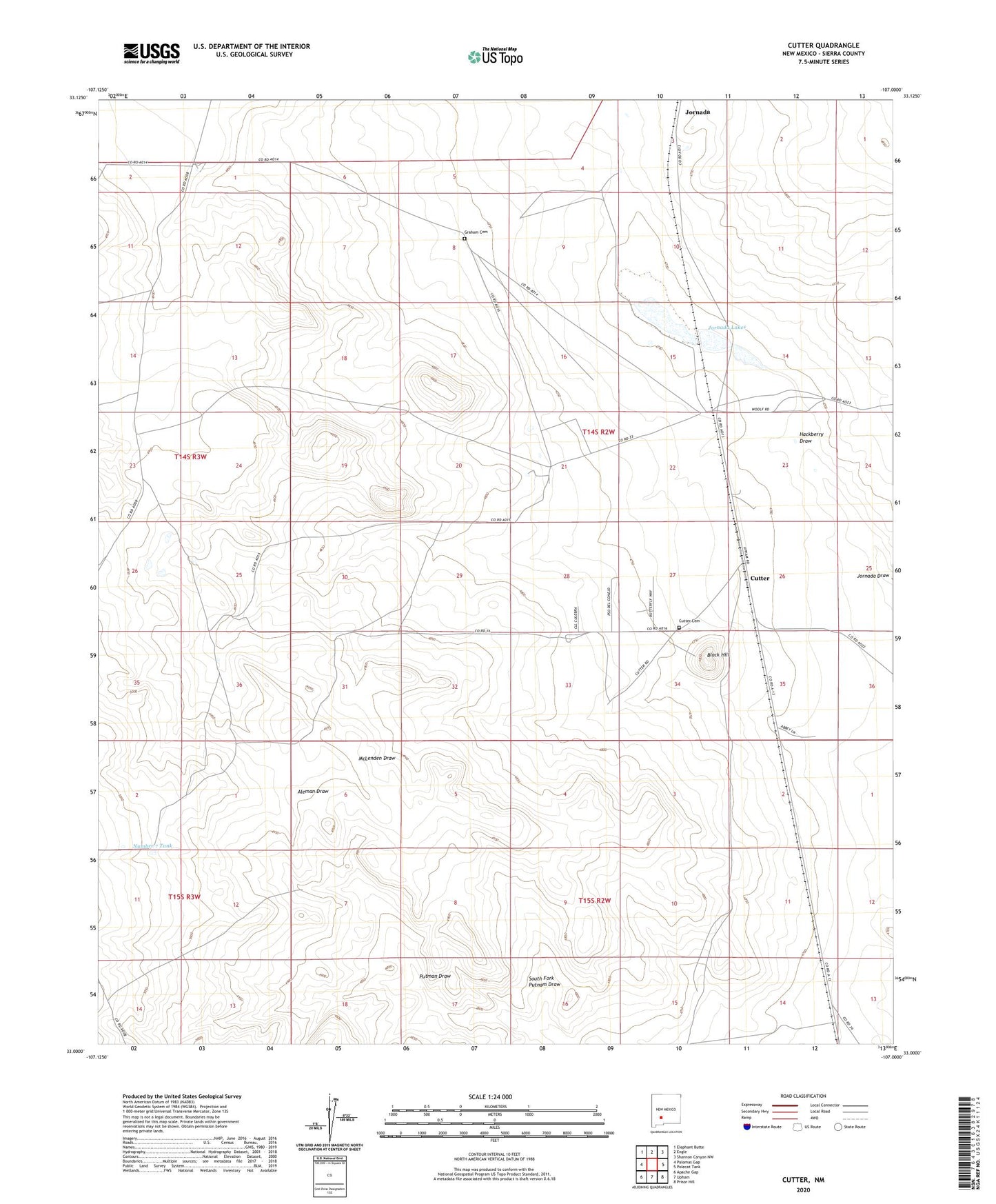
2023 topographic map quadrangle Cutter in the state of New Mexico. Scale: 1:24000. Based on the newly updated USGS 7.5' US Topo map series, this map is in the following counties: Sierra. The map contains contour data, water features, and other items you are used to seeing on USGS maps, but also has updated roads and other features. This is the next generation of topographic maps. Printed on high-quality waterproof paper with UV fade-resistant inks.
Quads adjacent to this one:
West: Palomas Gap
Northwest: Elephant Butte
North: Engle
Northeast: Shannon Canyon NW
East: Polecat Tank
Southeast: Prisor Hill
South: Upham
Southwest: Apache Gap
This map covers the same area as the classic USGS quad with code o33107a1.
Contains the following named places: Black Hill, Corner Windmill, Cutter, Cutter Cemetery, Cutter Post Office, Cutter Tank, Gilmore Well, Graham Cemetery, Hackberry Draw, Jornada, Jornada Lakes, Jornado Weather Station, L Seven Ranch, Mares Windmill, McLendon Ranch, Middle Well, Number 7 Tank, Putman Draw, Putman Windmill, Reineke Windmill, South Fork Putnam Draw, South Windmill, Sowell Windmill, Walsh Windmill