MyTopo
Ramon SW New Mexico US Topo Map
Couldn't load pickup availability
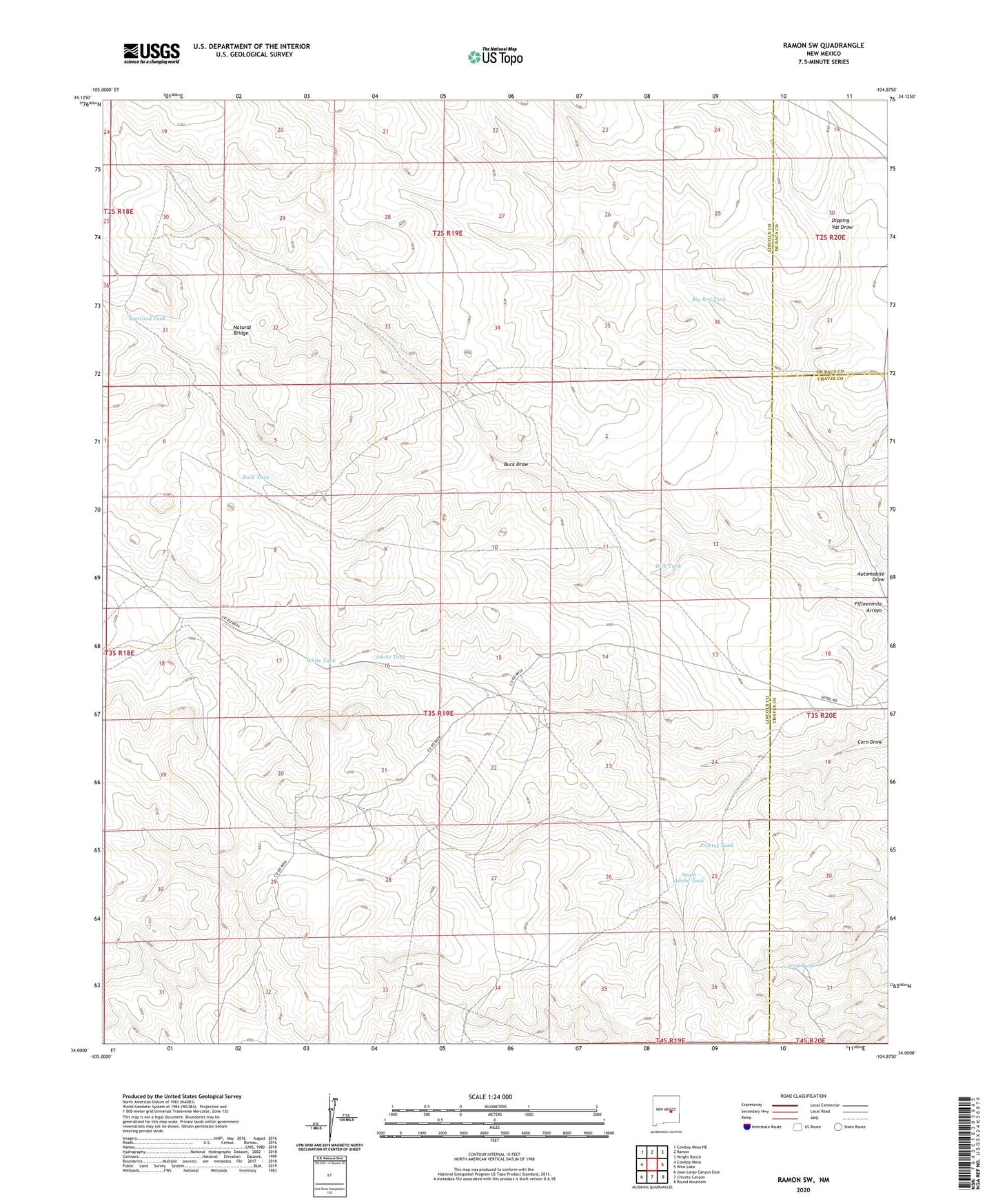
2023 topographic map quadrangle Ramon SW in the state of New Mexico. Scale: 1:24000. Based on the newly updated USGS 7.5' US Topo map series, this map is in the following counties: Lincoln, Chaves, De Baca. The map contains contour data, water features, and other items you are used to seeing on USGS maps, but also has updated roads and other features. This is the next generation of topographic maps. Printed on high-quality waterproof paper with UV fade-resistant inks.
Quads adjacent to this one:
West: Cowboy Mesa
Northwest: Cowboy Mesa NE
North: Ramon
Northeast: Wright Ranch
East: Wire Lake
Southeast: Round Mountain
South: Chivata Canyon
Southwest: Juan Largo Canyon East
This map covers the same area as the classic USGS quad with code o34104a8.
Contains the following named places: Adobe Tank, Big Red Tank, Buck Draw, Buck Tank, Dick Tank, Dipping Vat Draw, Fifteenmile Well, Middle Well, Natural Bridge, Nester Well, New Ball Well, Old Ball Well, Procter Tank, Railroad Tank, Shearing Shed Camp, Shearing Shed Well, South Adobe Tank, West Camp, West Tank, White Tank