MyTopo
Wright Ranch New Mexico US Topo Map
Couldn't load pickup availability
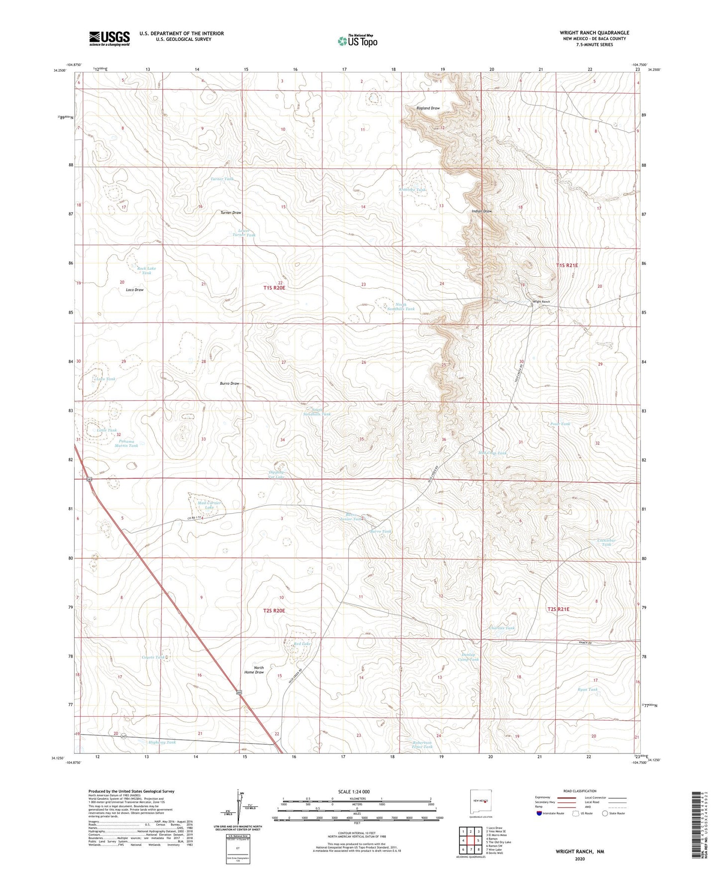
2023 topographic map quadrangle Wright Ranch in the state of New Mexico. Scale: 1:24000. Based on the newly updated USGS 7.5' US Topo map series, this map is in the following counties: De Baca. The map contains contour data, water features, and other items you are used to seeing on USGS maps, but also has updated roads and other features. This is the next generation of topographic maps. Printed on high-quality waterproof paper with UV fade-resistant inks.
Quads adjacent to this one:
West: Ramon
Northwest: Loco Draw
North: Yeso Mesa SE
Northeast: El Morro Mesa
East: The Old Dry Lake
Southeast: Devils Well
South: Wire Lake
Southwest: Ramon SW
This map covers the same area as the classic USGS quad with code o34104b7.
Contains the following named places: Antelope Tank, Berts Well, Burro Junior Tank, Burro Tank, Charlies Tank, Cocklebur Tank, Coyote Tank, Dipping Vat Lake, Dunlap Camp Tank, Electric Wells, High Lonesome Windmill, Highway Tank, Hub Corn Tank, Little Tank, Loco Draw, Loco Tank, Lower Turner Tank, Mail Carrier Lake, Mexican Lake Wells, Miller Wells, North Sandhills Tank, Panama Martin Tank, Posie Tank, Red Lake, Robertson Fence Tank, Rock Lake Tank, Ryan Tank, Six Windmills, South Sandhills Tank, Turner Draw, Turner Tank, White Rock Tank, Wright Ranch