MyTopo
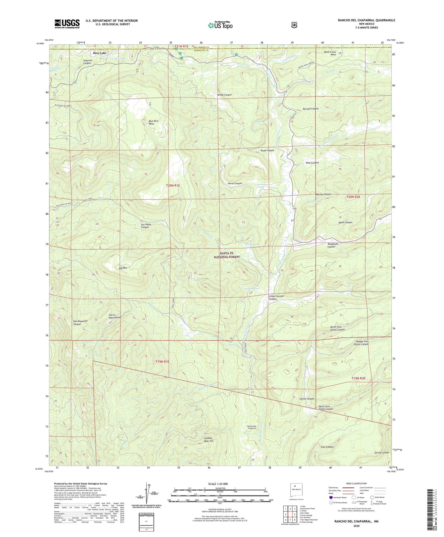
Rancho del Chaparral New Mexico US Topo Map
Couldn't load pickup availability
Also explore the Rancho del Chaparral Forest Service Topo of this same quad for updated USFS data
2023 topographic map quadrangle Rancho del Chaparral in the state of New Mexico. Scale: 1:24000. Based on the newly updated USGS 7.5' US Topo map series, this map is in the following counties: Sandoval, Rio Arriba. The map contains contour data, water features, and other items you are used to seeing on USGS maps, but also has updated roads and other features. This is the next generation of topographic maps. Printed on high-quality waterproof paper with UV fade-resistant inks.
Quads adjacent to this one:
West: San Pablo
Northwest: Cuba
North: Nacimiento Peak
Northeast: Jarosa
East: Seven Springs
Southeast: Jemez Springs
South: San Miguel Mountain
Southwest: La Ventana
This map covers the same area as the classic USGS quad with code o35106h7.
Contains the following named places: American Creek, APS Camp, Barley Canyon, Barley Spring, Big Mountain, Blue Bird Mesa, Burned Canyon, Clear Creek, Clear Creek Campground, Cuba Ranger District, Deer Lake, Horse Canyon, Jewell Prospect, Krause Tank, Middle Fork Ojitos Canyon, Moon Canyon, North Fork Ojitos Canyon, Ojitos Canyon, Ojitos Logging Camp, Rancho del Chaparral, Redtop Spring, Rio las Vacas Cabin, Rio las Vacas Campground, Rito de las Palomas, Rito del Indio, Rito Penas Negras, Road Canyon, Rock Creek, Rock Creek Mesa, School Section Canyon, Smokey Bear Hill, South Fork Ojitos Canyon, Telephone Canyon, Trail Creek, Turkey Creek, Turkey Spring, Vacas Spring, Vacus Spring, Windy Canyon, Wolf Canyon