MyTopo
Nacimiento Peak New Mexico US Topo Map
Couldn't load pickup availability
Also explore the Nacimiento Peak Forest Service Topo of this same quad for updated USFS data
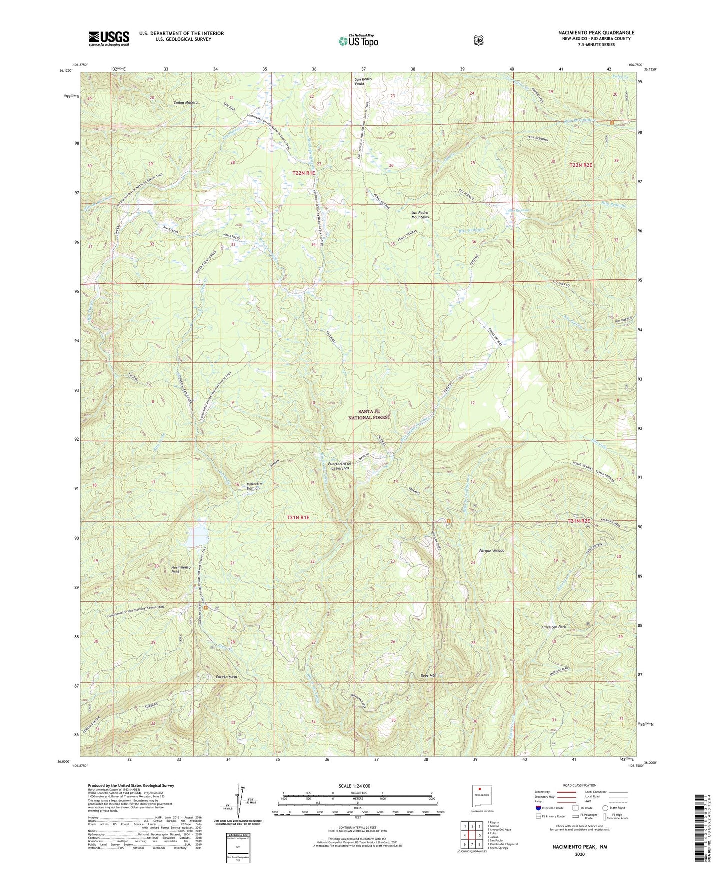
2023 topographic map quadrangle Nacimiento Peak in the state of New Mexico. Scale: 1:24000. Based on the newly updated USGS 7.5' US Topo map series, this map is in the following counties: Rio Arriba. The map contains contour data, water features, and other items you are used to seeing on USGS maps, but also has updated roads and other features. This is the next generation of topographic maps. Printed on high-quality waterproof paper with UV fade-resistant inks.
Quads adjacent to this one:
West: Cuba
Northwest: Regina
North: Gallina
Northeast: Arroyo Del Agua
East: Jarosa
Southeast: Seven Springs
South: Rancho del Chaparral
Southwest: San Pablo
This map covers the same area as the classic USGS quad with code o36106a7.
Contains the following named places: American Park, Clear Creek Recreation Site, Clear Creek Trail, Corralitos Creek, Cuba Ditch, Deer Mountain, El Cajete, Eureka Mesa, Highline Trail, Los Pinos Trail, Nacimiento Campground, Nacimiento Peak, Oso Creek, Palomas Trail, Parque Venado, Penas Negras Trail, Perchas Trail, Puertecito de las Perchas, Redonda Trail, Rito Anastacio, Rito de las Perchas, San Gregorio Reservoir, San Gregorio Reservoir Dam, San Pedro Cabin, San Pedro Mountains, San Pedro Parks, San Pedro Parks Wilderness, San Pedro Peaks, Santa Fe National Forest, Vallecito Damian, Vega del Oso, Vega Redonda