MyTopo
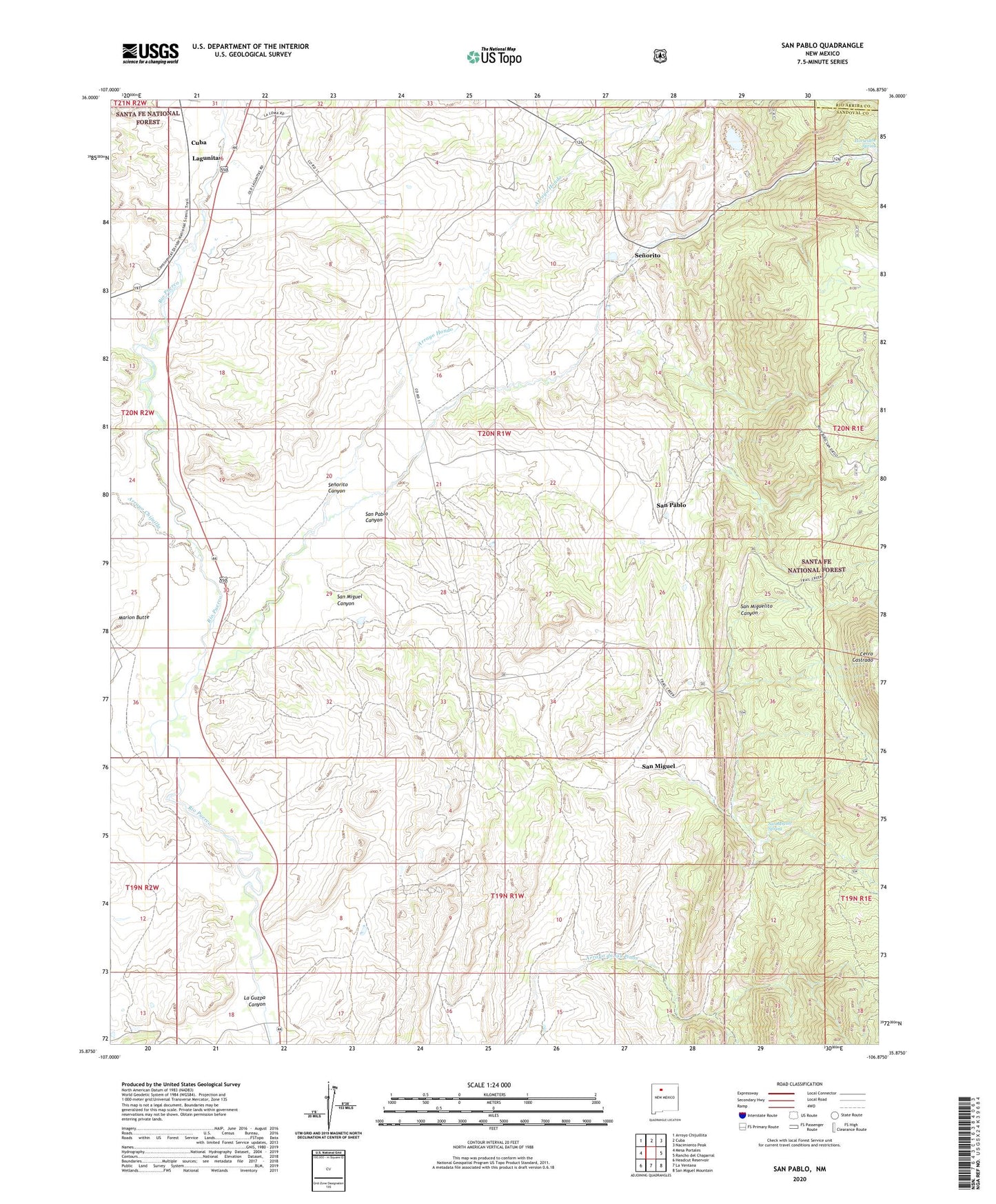
San Pablo New Mexico US Topo Map
Couldn't load pickup availability
Also explore the San Pablo Forest Service Topo of this same quad for updated USFS data
2023 topographic map quadrangle San Pablo in the state of New Mexico. Scale: 1:24000. Based on the newly updated USGS 7.5' US Topo map series, this map is in the following counties: Sandoval, Rio Arriba. The map contains contour data, water features, and other items you are used to seeing on USGS maps, but also has updated roads and other features. This is the next generation of topographic maps. Printed on high-quality waterproof paper with UV fade-resistant inks.
Quads adjacent to this one:
West: Mesa Portales
Northwest: Arroyo Chijuillita
North: Cuba
Northeast: Nacimiento Peak
East: Rancho del Chaparral
Southeast: San Miguel Mountain
South: La Ventana
Southwest: Headcut Reservoir
This map covers the same area as the classic USGS quad with code o35106h8.
Contains the following named places: Alpha Humas Pit, Arroyo Chijuilla, Arroyo Hondo, Black Rose Prospect, Blue Bird Ranch, Blue Bird Ranger Station, Brandy 2 Water Well, Campo el Deseo, Cerro Castrado, Cuba Landfill, Dennison - Bunn Prospect, Don Number 11, Horseshoe Spring, La Guzpa Canyon, Lagunitas, Marion Butte, Mauldian Prospect, McDonald and Kissler Prospect, Nacimiento Copper Mine, Nacimiento Mine, Padilla Mine, San Miguel, San Miguel - Padilla Mine, San Miguel Canyon, San Miguel Elementary School, San Miguel Mine, San Miguel School, San Miguel Spring, San Miguelito Canyon, San Pablo, San Pablo Canyon, San Ysidro Number One Humos Pit, Sandoval County Sheriff's Office Cuba, Senorita Mine, Senorito, Senorito Canyon, Senorito Post Office, Warm Springs Mine