MyTopo
Rayo Hills New Mexico US Topo Map
Couldn't load pickup availability
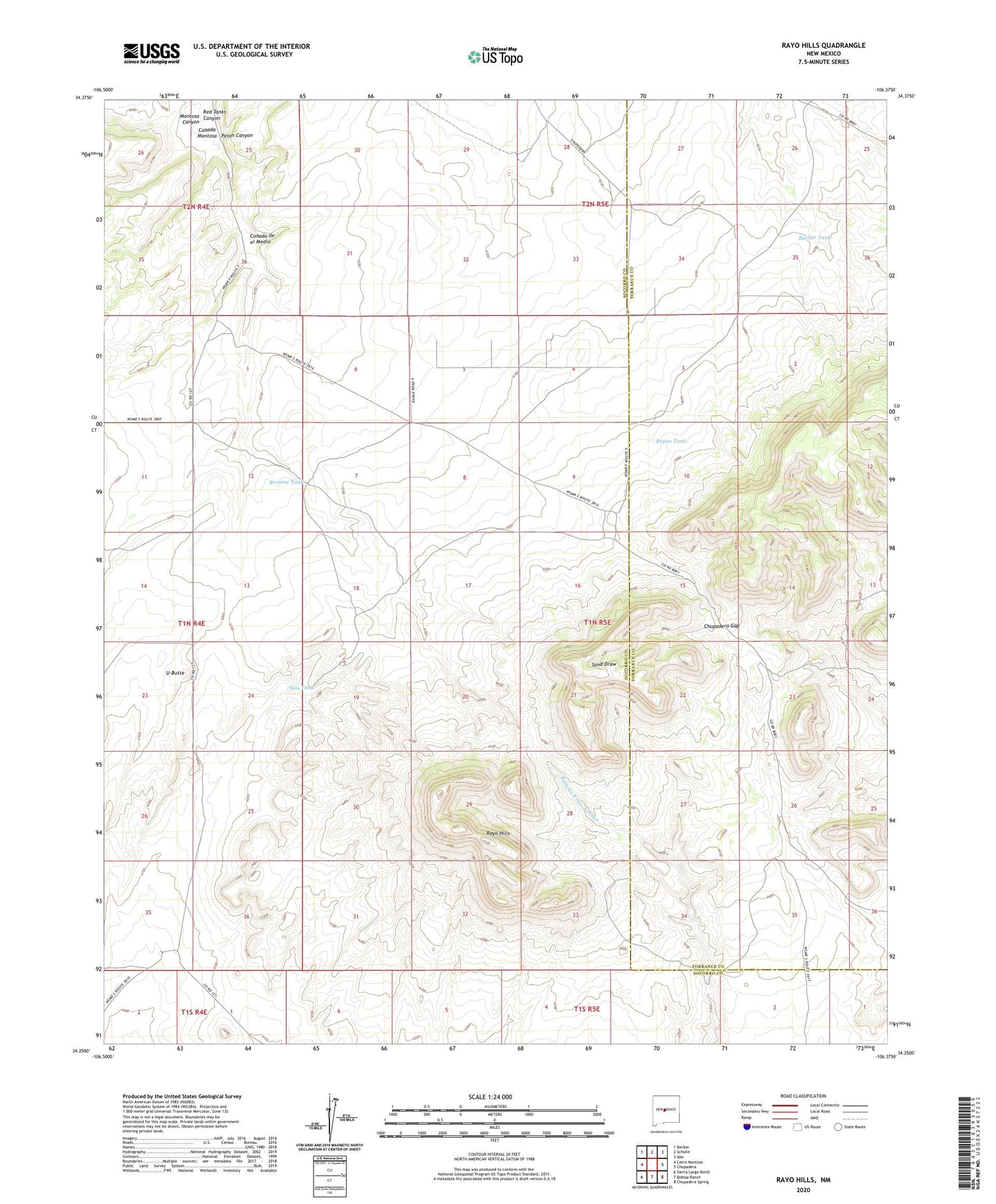
2020 topographic map quadrangle Rayo Hills in the state of New Mexico. Scale: 1:24000. Based on the newly updated USGS 7.5' US Topo map series, this map is in the following counties: Socorro, Torrance. The map contains contour data, water features, and other items you are used to seeing on USGS maps, but also has updated roads and other features. This is the next generation of topographic maps. Printed on high-quality waterproof paper with UV fade-resistant inks.
Quads adjacent to this one:
West: Cerro Montoso
Northwest: Becker
North: Scholle
Northeast: Abo
East: Chupadera
Southeast: Chupadera Spring
South: Bishop Ranch
Southwest: Sierra Larga North
Contains the following named places: Barber Tank, Brazil Windmill, Broome Tank, Bryan Tank, Canada de el Medio, Chupadera Gap, Iron King, Montosa Canyon, Pelon Canyon, Rancho Viejo Well, Rayo Hills, Red Tanks Canyon, Sais Tank, U-Butte