MyTopo
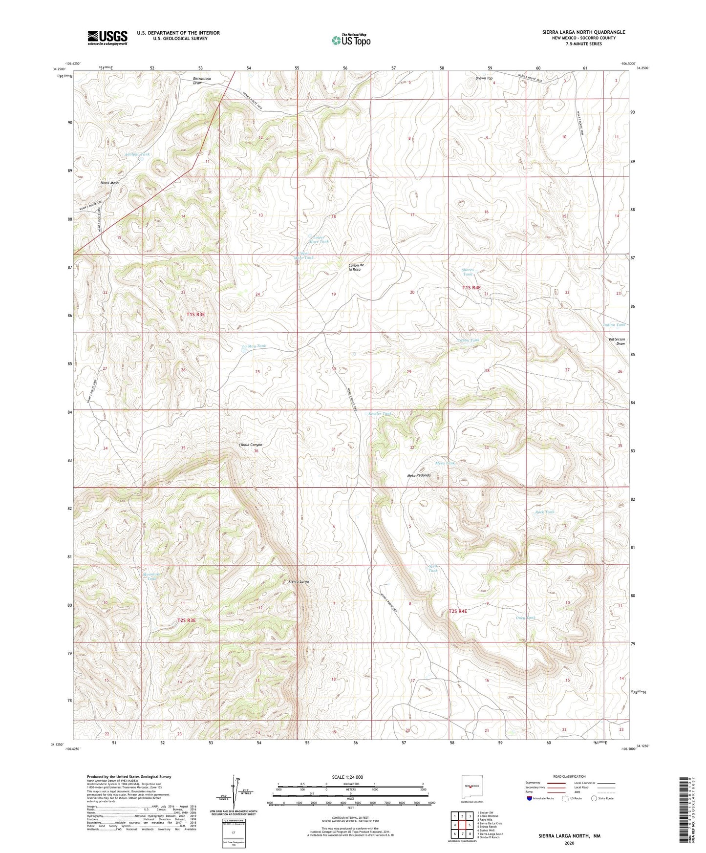
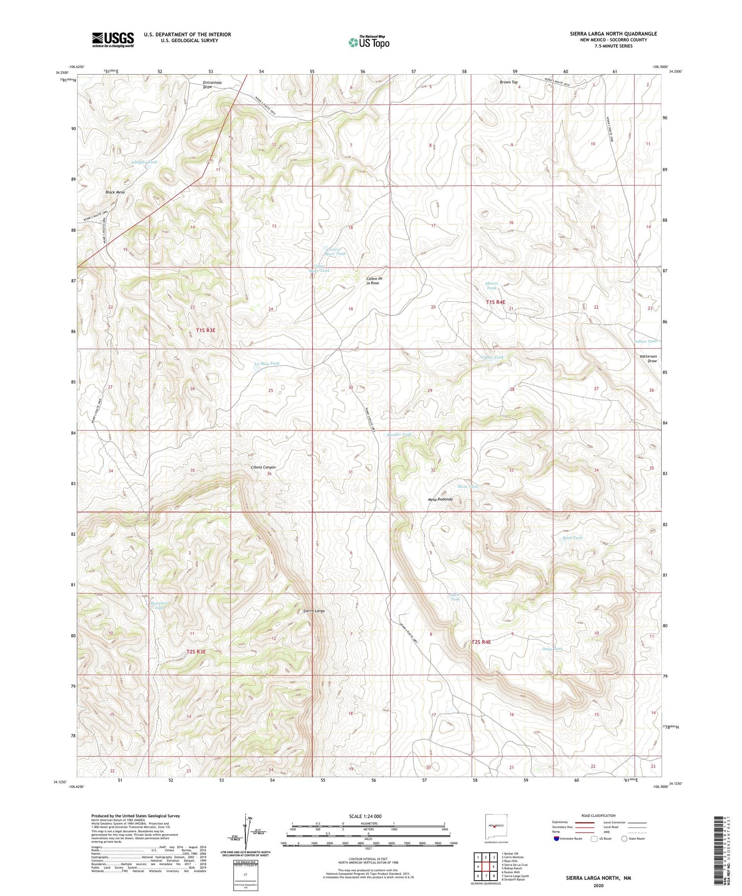
Sierra Larga North New Mexico US Topo Map
Couldn't load pickup availability
2023 topographic map quadrangle Sierra Larga North in the state of New Mexico. Scale: 1:24000. Based on the newly updated USGS 7.5' US Topo map series, this map is in the following counties: Socorro. The map contains contour data, water features, and other items you are used to seeing on USGS maps, but also has updated roads and other features. This is the next generation of topographic maps. Printed on high-quality waterproof paper with UV fade-resistant inks.
Quads adjacent to this one:
West: Sierra De La Cruz
Northwest: Becker SW
North: Cerro Montoso
Northeast: Rayo Hills
East: Bishop Ranch
Southeast: Orndorff Ranch
South: Sierra Larga South
Southwest: Bustos Well
This map covers the same area as the classic USGS quad with code o34106b5.
Contains the following named places: Adolpho Tank, Black Mesa, Booster Windmill, Brown Top, Canon Tank, Entraniosa Draw, Indian Tank, Kessler Tank, La May Tank, Lower Marr Tank, Mesa Redonda, Mesa Tank, Mountain Tank, Oney Tank, Ponciana Water Well, Rock Tank, Shores Tank, Split Tank, Stallion Wilderness Study Area, Upper Marr Tank