MyTopo
Owl Hills Texas US Topo Map
Couldn't load pickup availability
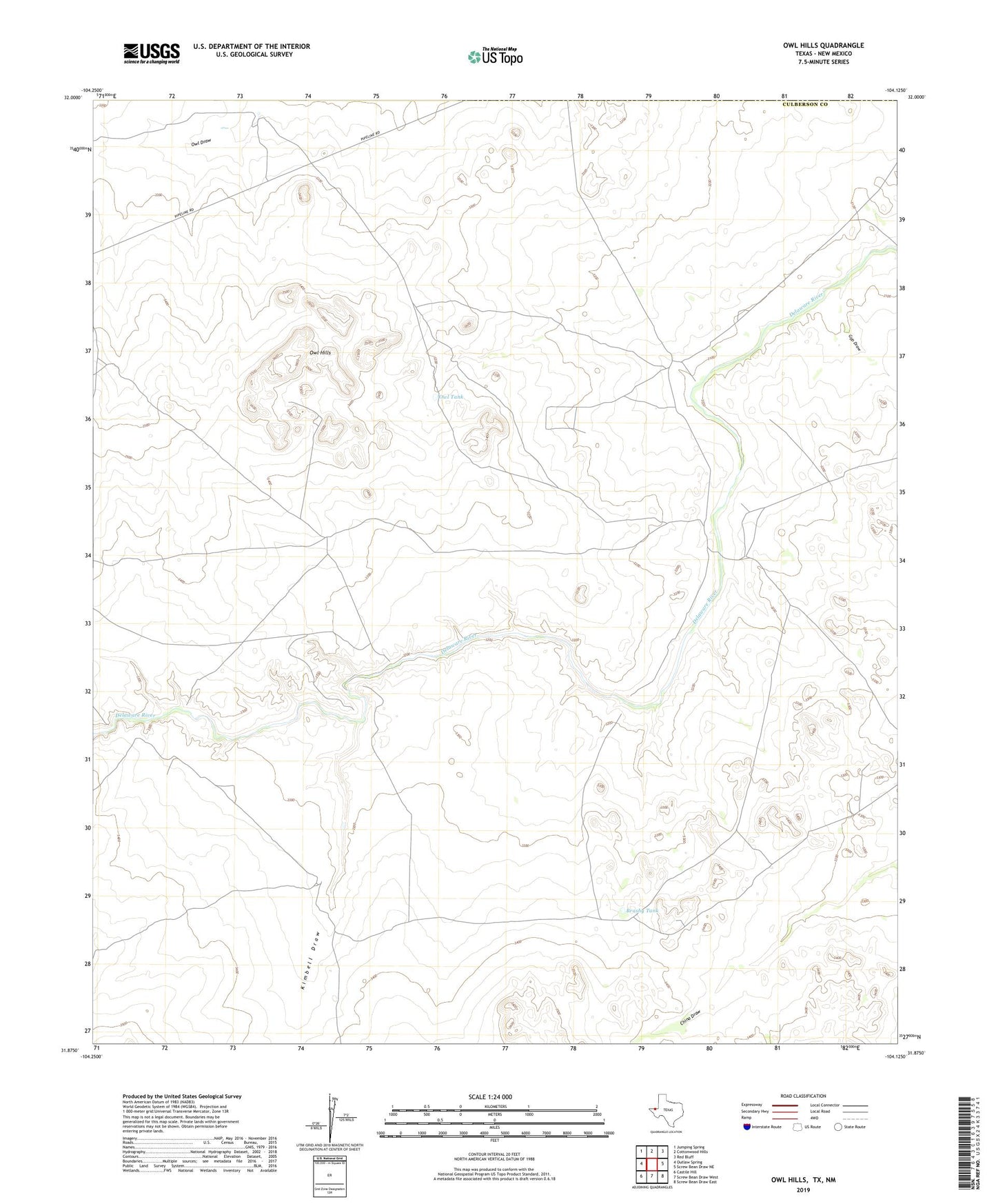
2022 topographic map quadrangle Owl Hills in the state of Texas. Scale: 1:24000. Based on the newly updated USGS 7.5' US Topo map series, this map is in the following counties: Culberson, Eddy. The map contains contour data, water features, and other items you are used to seeing on USGS maps, but also has updated roads and other features. This is the next generation of topographic maps. Printed on high-quality waterproof paper with UV fade-resistant inks.
Quads adjacent to this one:
West: Outlaw Spring
Northwest: Jumping Spring
North: Cottonwood Hills
Northeast: Red Bluff
East: Screw Bean Draw NE
Southeast: Screw Bean Draw East
South: Screw Bean Draw West
Southwest: Castile Hill
This map covers the same area as the classic USGS quad with code o31104h2.
Contains the following named places: Brushy Tank, Gyp Draw, Kimbell Draw, McWilliams Tank, North Windmill, Owl Hills, Owl Tank, Prewit Ranch