MyTopo
Valle Toledo New Mexico US Topo Map
Couldn't load pickup availability
Also explore the Valle Toledo Forest Service Topo of this same quad for updated USFS data
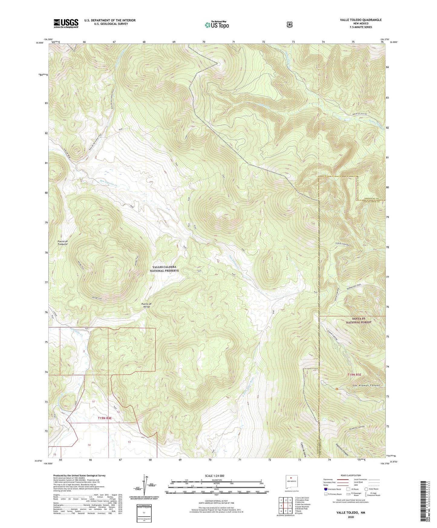
2023 topographic map quadrangle Valle Toledo in the state of New Mexico. Scale: 1:24000. Based on the newly updated USGS 7.5' US Topo map series, this map is in the following counties: Sandoval, Los Alamos. The map contains contour data, water features, and other items you are used to seeing on USGS maps, but also has updated roads and other features. This is the next generation of topographic maps. Printed on high-quality waterproof paper with UV fade-resistant inks.
Quads adjacent to this one:
West: Valle San Antonio
Northwest: Cerro del Grant
North: Polvadera Peak
Northeast: Vallecitos
East: Guaje Mountain
Southeast: Frijoles
South: Bland
Southwest: Redondo Peak
This map covers the same area as the classic USGS quad with code o35106h4.
Contains the following named places: Baca Location Number One, Camp May Recreation Site, Canada Bonita, Cerro del Medio, Cerro Pinon, Cerro Rubio, Cerro Santa Rosa, Cerro Toledo, Cerros de los Posos, Cerros del Abrigo, Indian Point, KNLA-FM (White Rock), KNYN-FM (Santa Fe), KRBL-FM (Los Alamos), Pajarito Canyon Trail, Pajarito Mountain, Pajarito Mountain Ski Area, Puerta de Trasquilar, Puerto de Abrigo, Rincon de los Soldados, Rito de los Indios, Shell Mountain, Sierra de los Valles, Sierra de Toledo, Turkey Canyon, Turkey Creek, Turkey Ridge, Valle de los Posos, Valle Jaramillo, Valle Toledo