MyTopo
Selden Canyon New Mexico US Topo Map
Couldn't load pickup availability
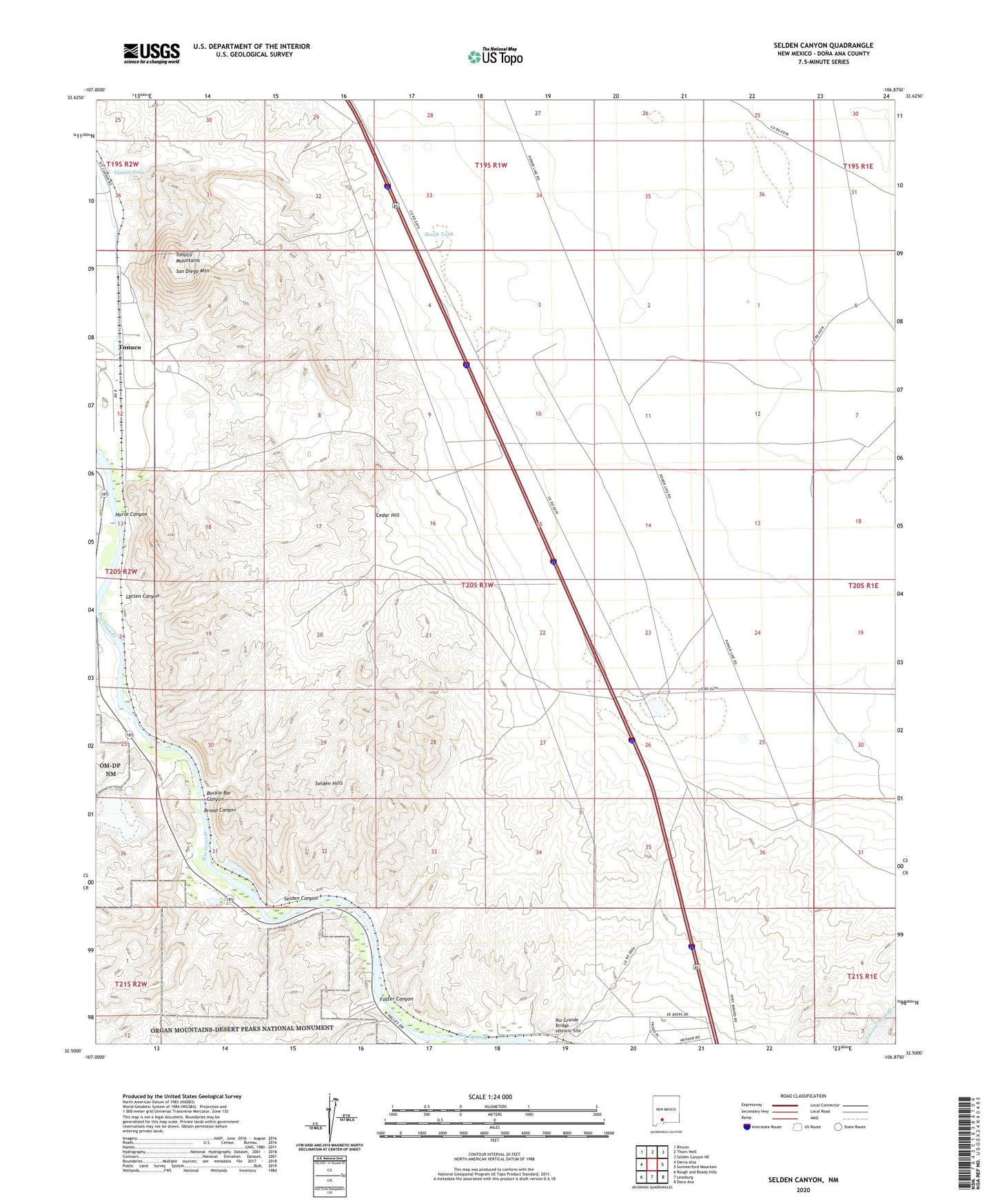
2023 topographic map quadrangle Selden Canyon in the state of New Mexico. Scale: 1:24000. Based on the newly updated USGS 7.5' US Topo map series, this map is in the following counties: Doña Ana. The map contains contour data, water features, and other items you are used to seeing on USGS maps, but also has updated roads and other features. This is the next generation of topographic maps. Printed on high-quality waterproof paper with UV fade-resistant inks.
Quads adjacent to this one:
West: Sierra Alta
Northwest: Rincon
North: Thorn Well
Northeast: Selden Canyon NE
East: Summerford Mountain
Southeast: Dona Ana
South: Leasburg
Southwest: Rough and Ready Hills
Contains the following named places: Albatross, Beal Ranch, Beulah May Group, Broad Canyon, Buckle Bar Canyon, Buckle Bar Well, Cedar Hill, Crow Broad Placitas Site One Dam, Foster Canyon, Garcia Mine, Horse Canyon, Hust Mine, Lytten Canyon, Lytten Well, Mayfield Well, Medler, Radium Springs, Rio Grande Bridge Historic Site, San Diego Mountain, Selden Canyon, Selden Hills, Selden Well, South Tank, Tonuco, Tonuco Draw, Tonuco Mine, Tonuco Mountains