MyTopo
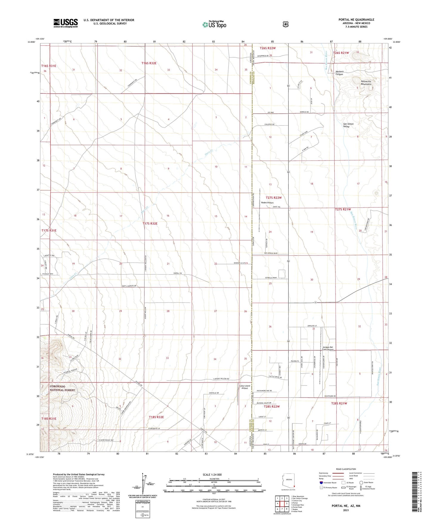
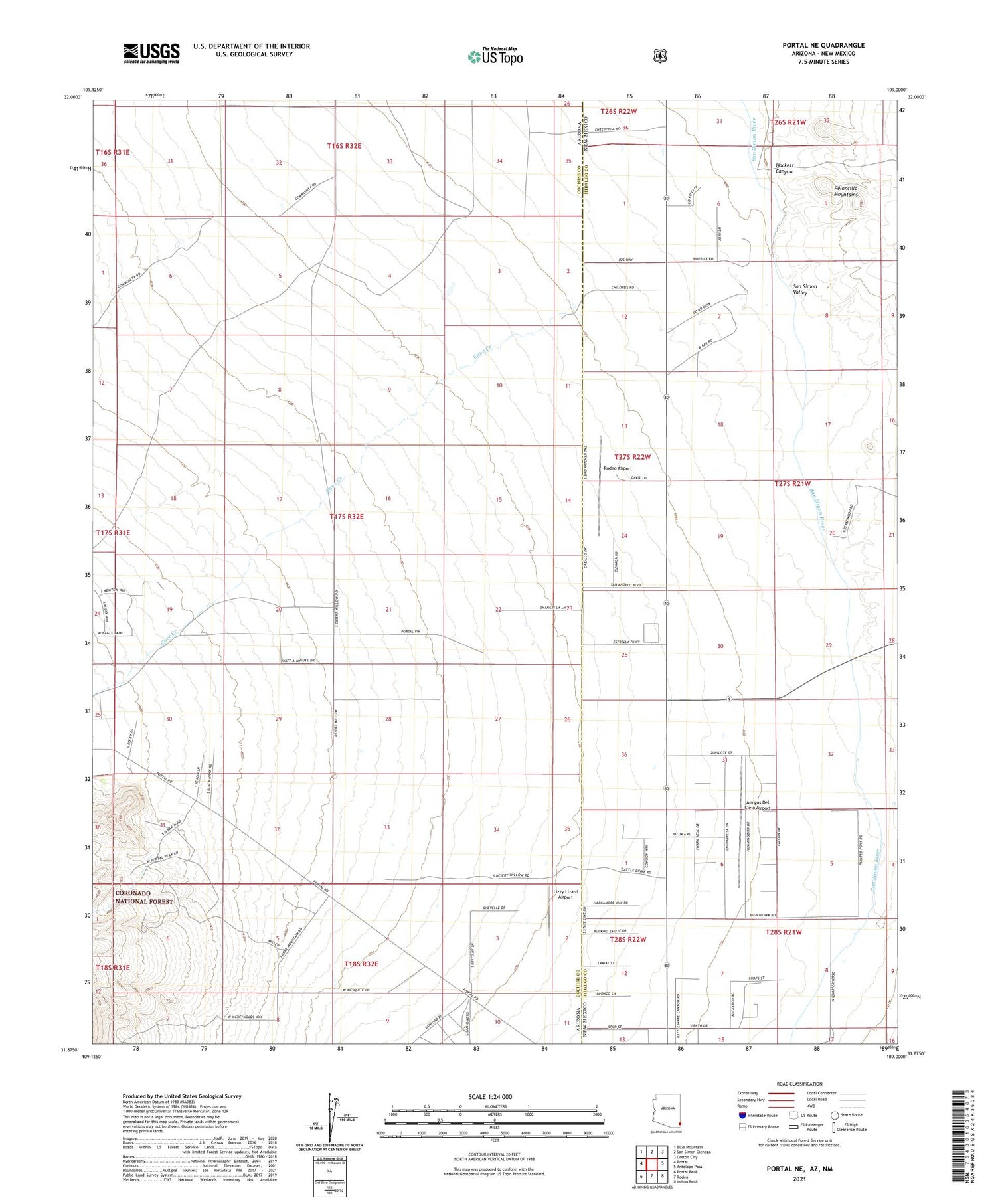
Portal NE Arizona US Topo Map
Couldn't load pickup availability
Also explore the Portal NE Forest Service Topo of this same quad for updated USFS data
2021 topographic map quadrangle Portal NE in the states of Arizona, New Mexico. Scale: 1:24000. Based on the newly updated USGS 7.5' US Topo map series, this map is in the following counties: Cochise, Hidalgo. The map contains contour data, water features, and other items you are used to seeing on USGS maps, but also has updated roads and other features. This is the next generation of topographic maps. Printed on high-quality waterproof paper with UV fade-resistant inks.
Quads adjacent to this one:
West: Portal
Northwest: Blue Mountain
North: San Simon Cienega
Northeast: Cotton City
East: Antelope Pass
Southeast: Indian Peak
South: Rodeo
Southwest: Portal Peak
Contains the following named places: 09001 Water Well, 09005 Water Well, Amigos Del Cielo Airport, Antelope Corral, Cave Creek, Hackett Canyon, Lizzy Lizard Airport, Roberds Ranch, Rodeo Airport, Stidham Ranch