
MyTopo
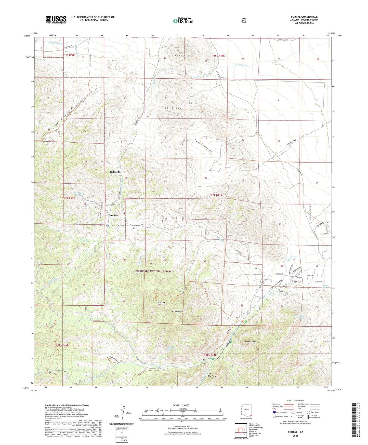
Portal Arizona US Topo Map
Couldn't load pickup availability
Also explore the Portal Forest Service Topo of this same quad for updated USFS data
2021 topographic map quadrangle Portal in the state of Arizona. Scale: 1:24000. Based on the newly updated USGS 7.5' US Topo map series, this map is in the following counties: Cochise. The map contains contour data, water features, and other items you are used to seeing on USGS maps, but also has updated roads and other features. This is the next generation of topographic maps. Printed on high-quality waterproof paper with UV fade-resistant inks.
Quads adjacent to this one:
West: Rustler Park
Northwest: Cochise Head
North: Blue Mountain
Northeast: San Simon Cienega
East: Portal NE
Southeast: Rodeo
South: Portal Peak
Southwest: Chiricahua Peak
This map covers the same area as the classic USGS quad with code o31109h2.
Contains the following named places: Bagwell Ranch, Cathedral Rock, Cave Creek Canyon, Cave Creek Regional Park, Chiricahua Tank, Cienega Spring, Cochise Mine, Davis Mountain, Galeyville, Harris Mountain, Hummingbird Spring, Idlewilde Forest Camp, Jhus Canyon, John Hands Picnic Ground, Mount Sceloporus, Onion Creek, Paradise, Paradise Cemetery, Peach Tree Spring, Portal, Portal Elementary School, Portal Ranger Station, Round Valley, Silver Creek, Silver Peak, Silver Tank, South Fork Cave Creek, Southwestern Research Station, Stewart Forest Camp, Sunny Flat Picnic Ground, The Portal


