MyTopo
Roy New Mexico US Topo Map
Couldn't load pickup availability
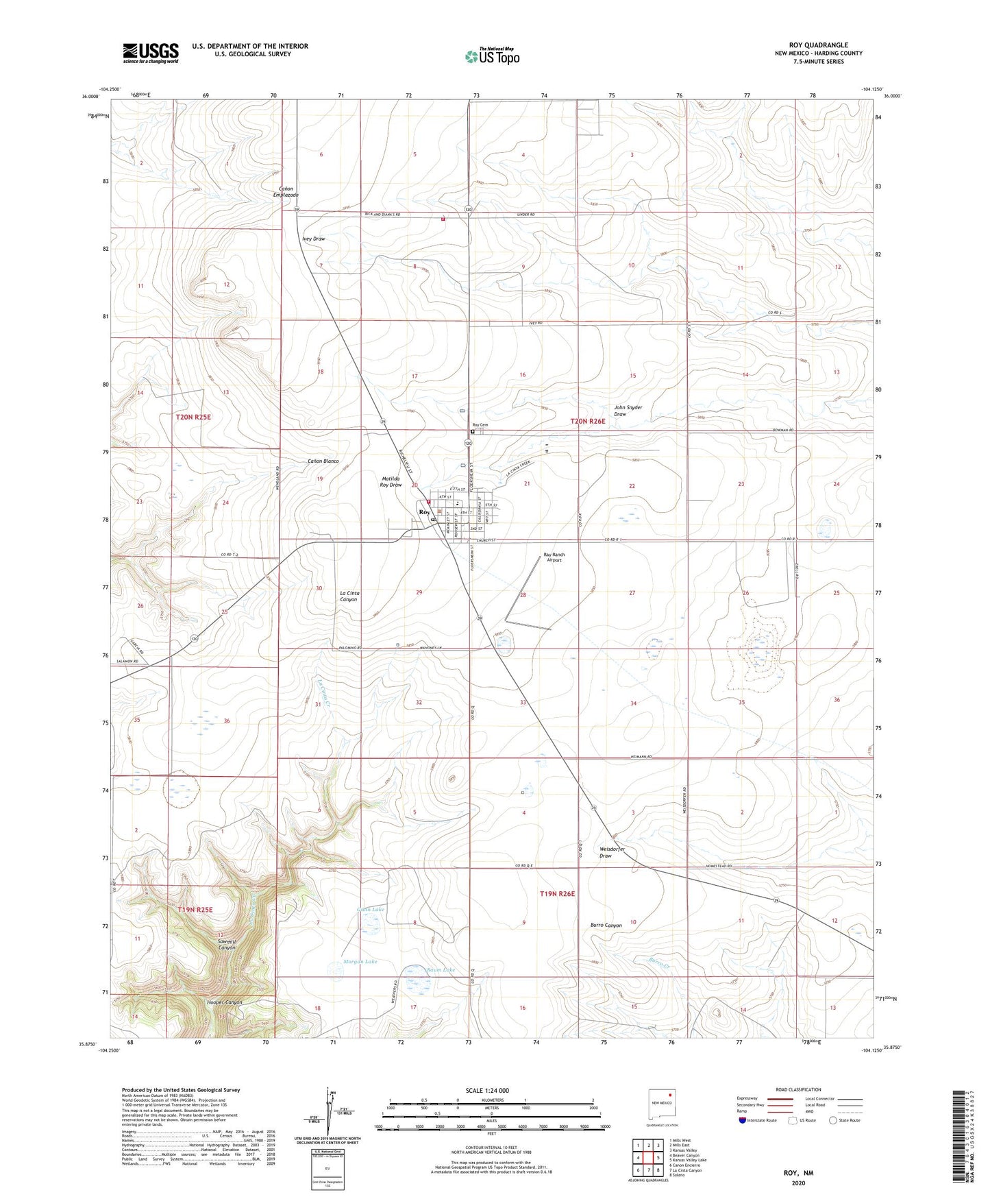
2020 topographic map quadrangle Roy in the state of New Mexico. Scale: 1:24000. Based on the newly updated USGS 7.5' US Topo map series, this map is in the following counties: Harding. The map contains contour data, water features, and other items you are used to seeing on USGS maps, but also has updated roads and other features. This is the next generation of topographic maps. Printed on high-quality waterproof paper with UV fade-resistant inks.
Quads adjacent to this one:
West: Beaver Canyon
Northwest: Mills West
North: Mills East
Northeast: Kansas Valley
East: Kansas Valley Lake
Southeast: Solano
South: La Cinta Canyon
Southwest: Canon Encierro
Contains the following named places: Baum Lake, Gunn Lake, Harding County Fire District 1 Headquarters, Health Centers of Northern New Mex Roy Clinic, Hooper Canyon, Ivey, John Snyder Draw, Kidd, Linder, Mahoney, Morgan Lake, Ray Ranch Airport, Roy, Roy Cemetery, Roy Elementary School, Roy High School, Roy Municipal Airport, Roy Post Office, Roy Rescue Service, Roy Village Marshal's Office, Roy Volunteer Fire Department, Roy Weather Station, Sawmill Canyon, Village of Roy, Weathers