MyTopo
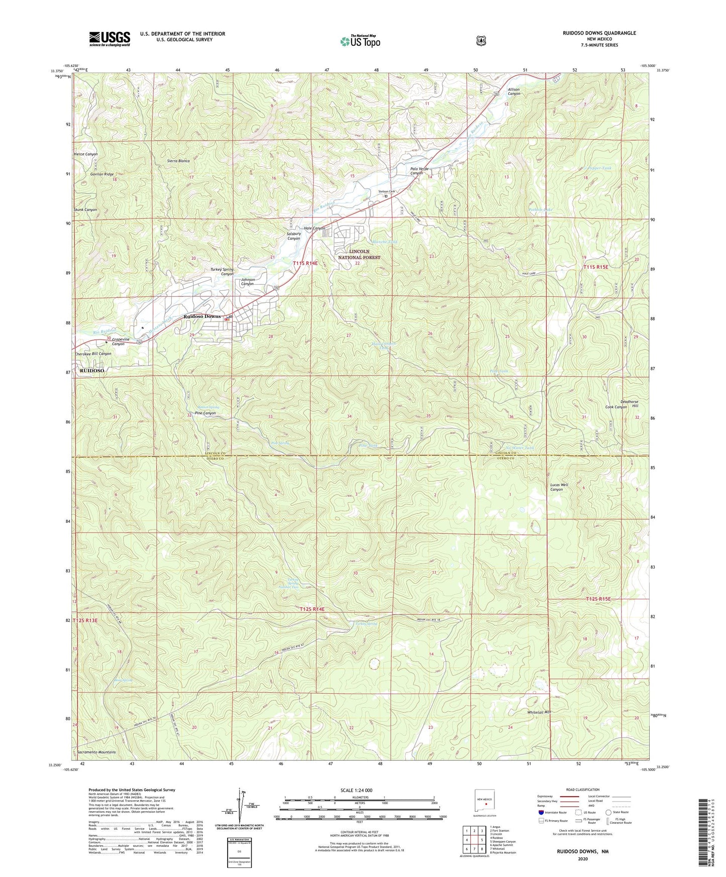
Ruidoso Downs New Mexico US Topo Map
Couldn't load pickup availability
Also explore the Ruidoso Downs Forest Service Topo of this same quad for updated USFS data
2023 topographic map quadrangle Ruidoso Downs in the state of New Mexico. Scale: 1:24000. Based on the newly updated USGS 7.5' US Topo map series, this map is in the following counties: Lincoln, Otero. The map contains contour data, water features, and other items you are used to seeing on USGS maps, but also has updated roads and other features. This is the next generation of topographic maps. Printed on high-quality waterproof paper with UV fade-resistant inks.
Quads adjacent to this one:
West: Ruidoso
Northwest: Angus
North: Fort Stanton
Northeast: Lincoln
East: Sheeppen Canyon
Southeast: Pajarita Mountain
South: Whitetail
Southwest: Apache Summit
This map covers the same area as the classic USGS quad with code o33105c5.
Contains the following named places: Allison Canyon, Baston Spring, Bear Spring, Beavers Pit, Blanche Tank, City of Ruidoso Downs, First Baptist Church, Fox Tank, Gavilan Ridge, Grapevine Canyon, Hale Canyon, Hale Canyon Tank, Herrera Ditch, Hollywood Pit, Johnson Canyon, KRUI-AM (Ruidoso Downs), No Water Tank, Pajarita Flats, Palo Verde Canyon, Pepper Tank, Pine Canyon, Pine Spring, Pine Tank, Pothole Lake, Red Bluff Tank, Ruidoso Christian School, Ruidoso Downs, Ruidoso Downs Police Department, Ruidoso Downs Post Office, Ruidoso Downs Race Track, Ruidoso Word Ministries, Salsbury Canyon, Seeping Springs Lakes, Seventh Day Adventist Church, Stetson Cemetery, Turkey Spring, Turkey Spring Canyon, Turkey Spring Number Two, Whitetail Mountain, ZIP Code: 88346