MyTopo
Sabinoso New Mexico US Topo Map
Couldn't load pickup availability
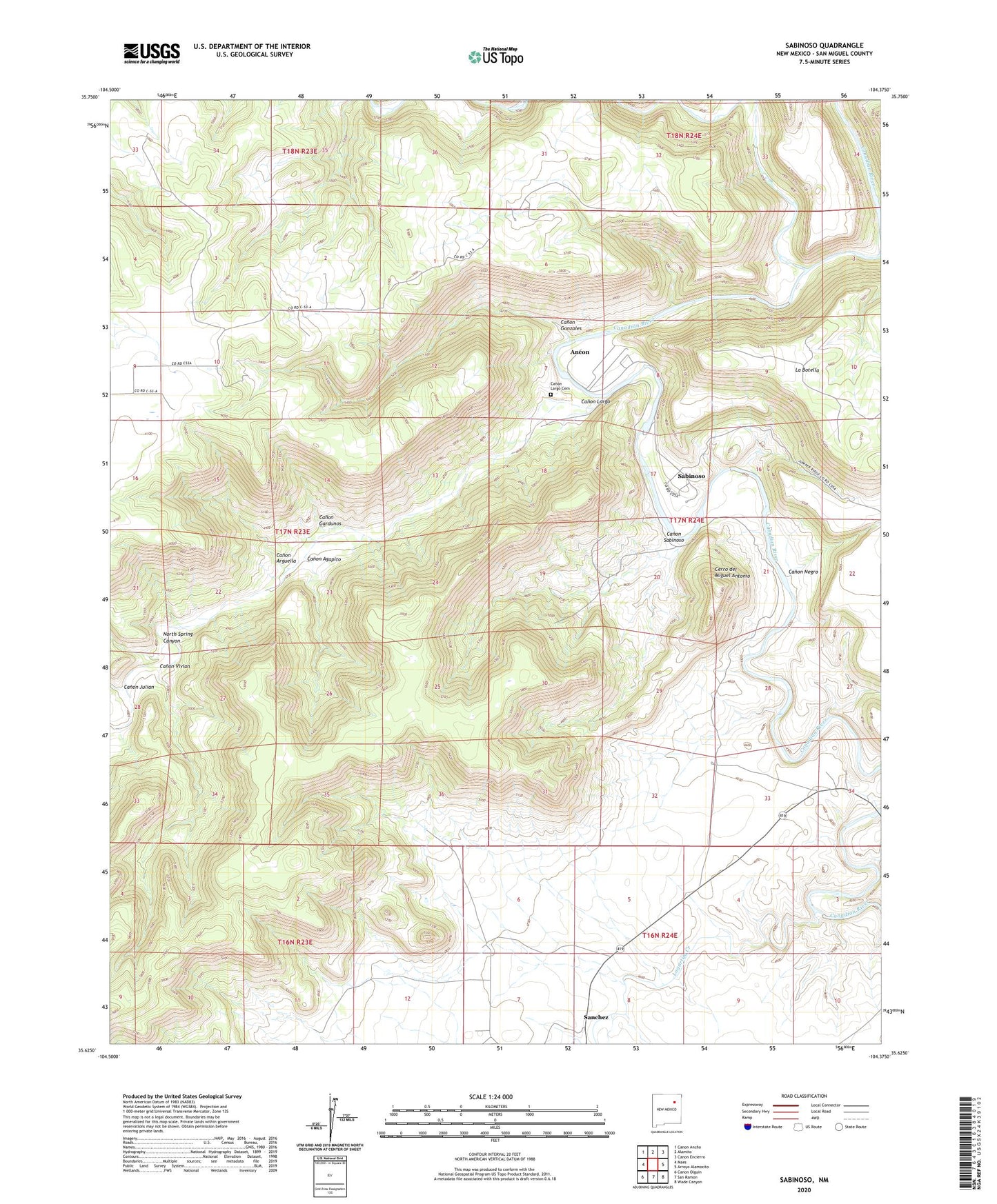
2020 topographic map quadrangle Sabinoso in the state of New Mexico. Scale: 1:24000. Based on the newly updated USGS 7.5' US Topo map series, this map is in the following counties: San Miguel. The map contains contour data, water features, and other items you are used to seeing on USGS maps, but also has updated roads and other features. This is the next generation of topographic maps. Printed on high-quality waterproof paper with UV fade-resistant inks.
Quads adjacent to this one:
West: Maes
Northwest: Canon Ancho
North: Alamito
Northeast: Canon Encierro
East: Arroyo Alamocito
Southeast: Wade Canyon
South: San Ramon
Southwest: Canon Olguin
Contains the following named places: Ancon, Balsofete, Bish Number Two Mine, Canon Agapito, Canon Arguella, Canon Gardunos, Canon Gonzales, Canon Julian, Canon Largo, Canon Largo Cemetery, Canon Negro, Canon Sabinoso, Canon Vivian, Cerro del Miguel Antonio, Cip Lujan, Gallegos, Hunt Oil Company Mine, Key Claims, La Botella, Lagartija Creek, Lesters Cabin, Lujan Cattle Company, Lujan Ranch, Medina, Mikie V Claims, Mora River, North Spring Canyon, SAB Mine, Sabinoso, Sabinoso Post Office, Sabinoso Wilderness Study Area, Sanchez, Sanchez Post Office, Santa Mission Church, T Claims, Upton, Verde Mine, Windy Number Nine Mine