MyTopo
Samson Lake New Mexico US Topo Map
Couldn't load pickup availability
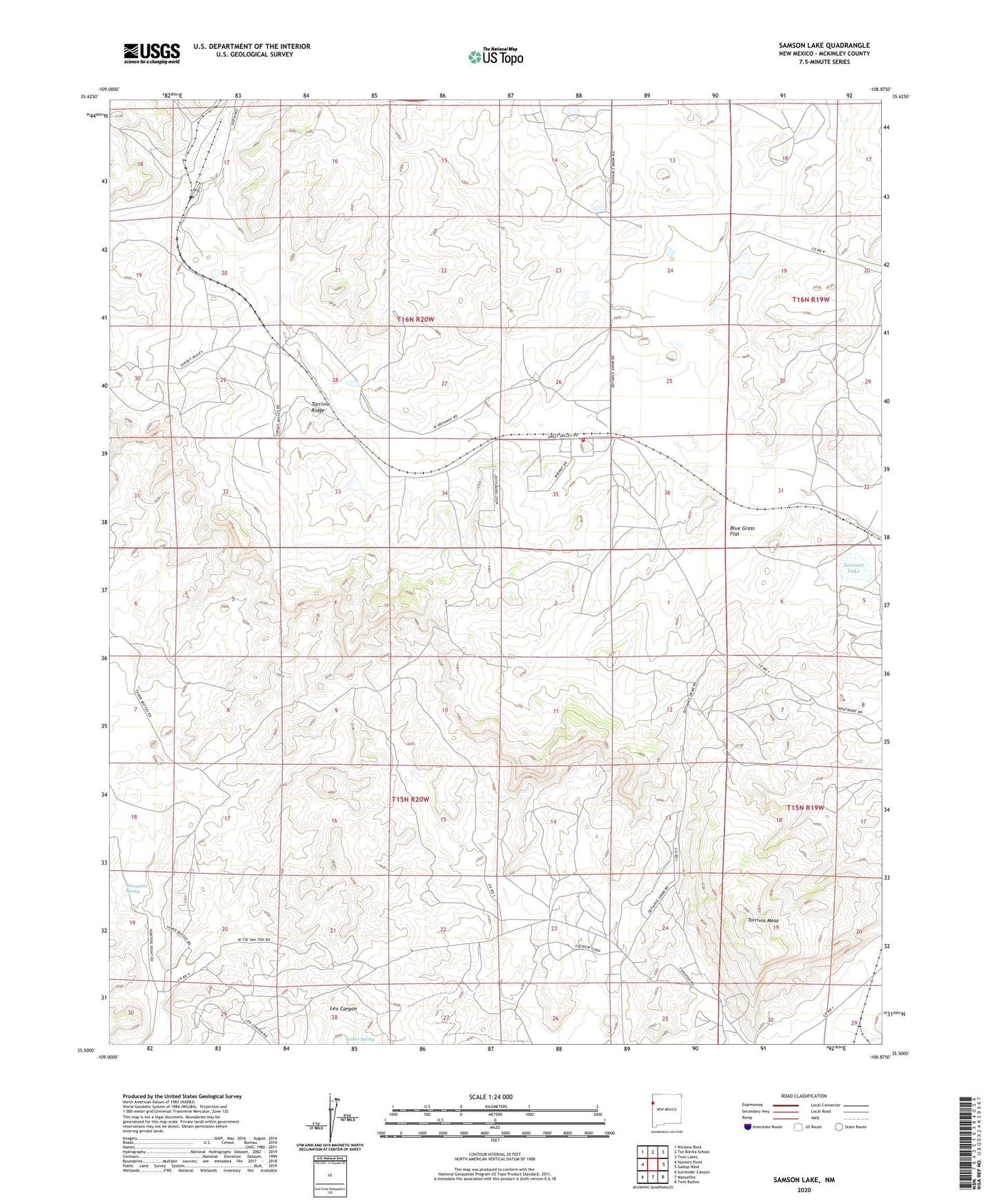
2020 topographic map quadrangle Samson Lake in the state of New Mexico. Scale: 1:24000. Based on the newly updated USGS 7.5' US Topo map series, this map is in the following counties: McKinley. The map contains contour data, water features, and other items you are used to seeing on USGS maps, but also has updated roads and other features. This is the next generation of topographic maps. Printed on high-quality waterproof paper with UV fade-resistant inks.
Quads adjacent to this one:
West: Hunters Point
Northwest: Window Rock
North: Tse Bonita School
Northeast: Twin Lakes
East: Gallup West
Southeast: Twin Buttes
South: Manuelito
Southwest: Surrender Canyon
Contains the following named places: 16T-339 Water Well, Blue Grass Flat, Burned Through the Rock Wash, Manuelito Spring, McKinley Mine, Navajo Estates Volunteer Fire Department Station 2, Parker Spring, Samson Lake, Torrivio Mesa, Torrivio Ridge, Tsayatoh Chapter, US Minning Section Six