MyTopo
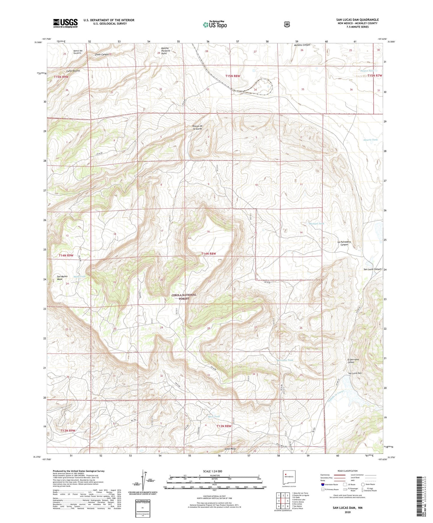
San Lucas Dam New Mexico US Topo Map
Couldn't load pickup availability
Also explore the San Lucas Dam Forest Service Topo of this same quad for updated USFS data
2023 topographic map quadrangle San Lucas Dam in the state of New Mexico. Scale: 1:24000. Based on the newly updated USGS 7.5' US Topo map series, this map is in the following counties: McKinley. The map contains contour data, water features, and other items you are used to seeing on USGS maps, but also has updated roads and other features. This is the next generation of topographic maps. Printed on high-quality waterproof paper with UV fade-resistant inks.
Quads adjacent to this one:
West: Ambrosia Lake
Northwest: Mesa De Los Toros
North: Piedra De La Aguila
Northeast: El Dado
East: Cerro Alesna
Southeast: Cerro Pelon
South: San Mateo
Southwest: Dos Lomas
This map covers the same area as the classic USGS quad with code o35107d6.
Contains the following named places: Alcario Tank, Baca Tank, Banco Isidro, Canada la Vacas, Canon Bonito, Dauber Tank, Derrame Tank, Desliz, Drift Mine, El Derrame Canon, Jose Gabriel Tank, La Polvadera Canyon, Laguna Polvadera, Leopoldo Diversion Dam, Melrich Group, Mesa Tank, Michael Tank, Piedra Tank, Polvadera Well, Rancho Perfecto Point, Rincon de la Gorda, San Lucas Dam, San Mateo Mesa, Uranium Deposit