MyTopo
Ambrosia Lake New Mexico US Topo Map
Couldn't load pickup availability
Also explore the Ambrosia Lake Forest Service Topo of this same quad for updated USFS data
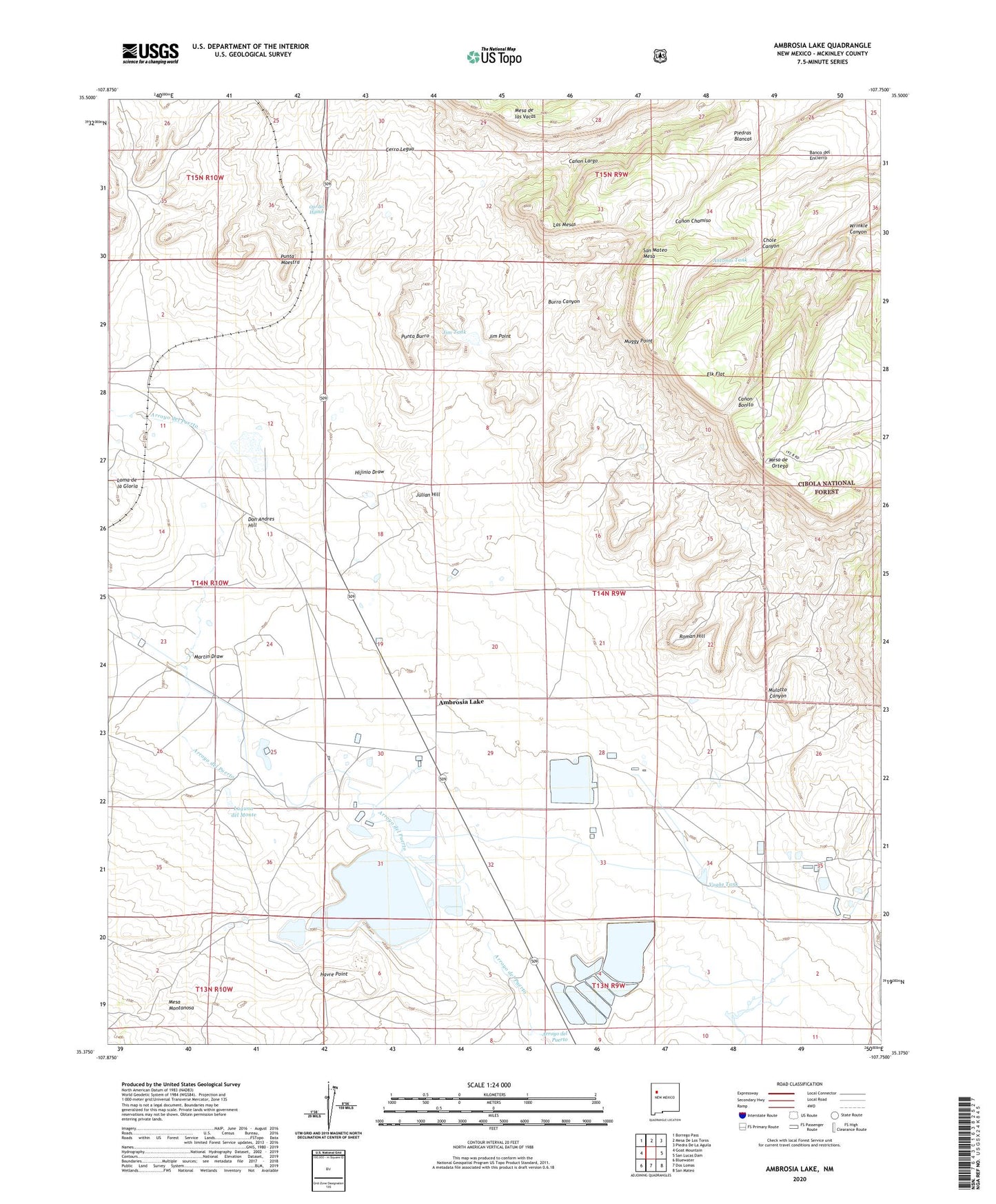
2023 topographic map quadrangle Ambrosia Lake in the state of New Mexico. Scale: 1:24000. Based on the newly updated USGS 7.5' US Topo map series, this map is in the following counties: McKinley. The map contains contour data, water features, and other items you are used to seeing on USGS maps, but also has updated roads and other features. This is the next generation of topographic maps. Printed on high-quality waterproof paper with UV fade-resistant inks.
Quads adjacent to this one:
West: Goat Mountain
Northwest: Borrego Pass
North: Mesa De Los Toros
Northeast: Piedra De La Aguila
East: San Lucas Dam
Southeast: San Mateo
South: Dos Lomas
Southwest: Bluewater
This map covers the same area as the classic USGS quad with code o35107d7.
Contains the following named places: 10012 Water Well, Ambrosia Lake, Ann Lee Mine Number One, Antonio Tank, Banco del Encierro, Berryhill Ranch, Buckey Number 1 Mine, Burro Canyon, Carter Well, Cerro Legua, Cerros Colorado, Cliffside Mine, Don Andres Hill, Dysart Mine Number 1, Elizabeth Group, Elk Flat, Green Pick Twenty Uranium Deposit, Havre Point, Hijinio Draw, Homestake-New Mexico Partners Mine, Homestake-Sapin Mine Number 23, Homestake-Sapin Mine Number 25, Ike Number 1, Jim Point, Jim Tank, Julian Hill, Kermac Mine Number 30, Kermac Nuclear Fuels Processing Plant, Kerr McGee Storage Dam, Kerr-McGee Tailings Dam Pond Number One, Laguna del Monte, Las Mesas, Loma de la Gloria, Martin Draw, Mary Number 1 Mine, Mesa de las Vacas, Mesa de Ortega, Mine Number 17, Mine Number 24, Muggy Point, Ojo del Hijinio, Phillips Petroleum Ambrosia Mill, Phillips Water Well, Punta Burro, Punta Maestra, Roman Hill, Sandstone Mine, Section Thirty-three Mine, United Western Mine, Voght Tank, Wrinkle Canyon