MyTopo
Selden Canyon NE New Mexico US Topo Map
Couldn't load pickup availability
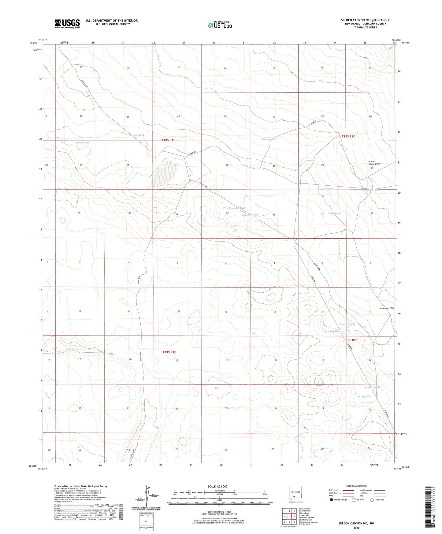
2023 topographic map quadrangle Selden Canyon NE in the state of New Mexico. Scale: 1:24000. Based on the newly updated USGS 7.5' US Topo map series, this map is in the following counties: Doña Ana. The map contains contour data, water features, and other items you are used to seeing on USGS maps, but also has updated roads and other features. This is the next generation of topographic maps. Printed on high-quality waterproof paper with UV fade-resistant inks.
Quads adjacent to this one:
West: Thorn Well
Northwest: Upham Hills
North: Gilmore Draw
Northeast: Fleck Draw
East: Goldenburg Draw
Southeast: Taylor Well
South: Summerford Mountain
Southwest: Selden Canyon
This map covers the same area as the classic USGS quad with code o32106f7.
Contains the following named places: Antelope Flat, Antelope Tank, Beacon Tank, Campbell Tank, Cassady Tank, CCC Tank, Chapline Tank, Coyote Tank, Engholm Tank, Estell Tank, Eugene Tank, Fleming Tank, Horse Camp Draw, Hurtt Tank, Keller Tank, Lawyer Tank, Lucero Tank, Middle Well, North Tanks, Pierce Tank, Powers Tank, Price Tank, Rawhide Tank, Red Lake, Red Lake Well, Tobosa Tank, Valentine Tank, Yucca Tank