MyTopo
Summerford Mountain New Mexico US Topo Map
Couldn't load pickup availability
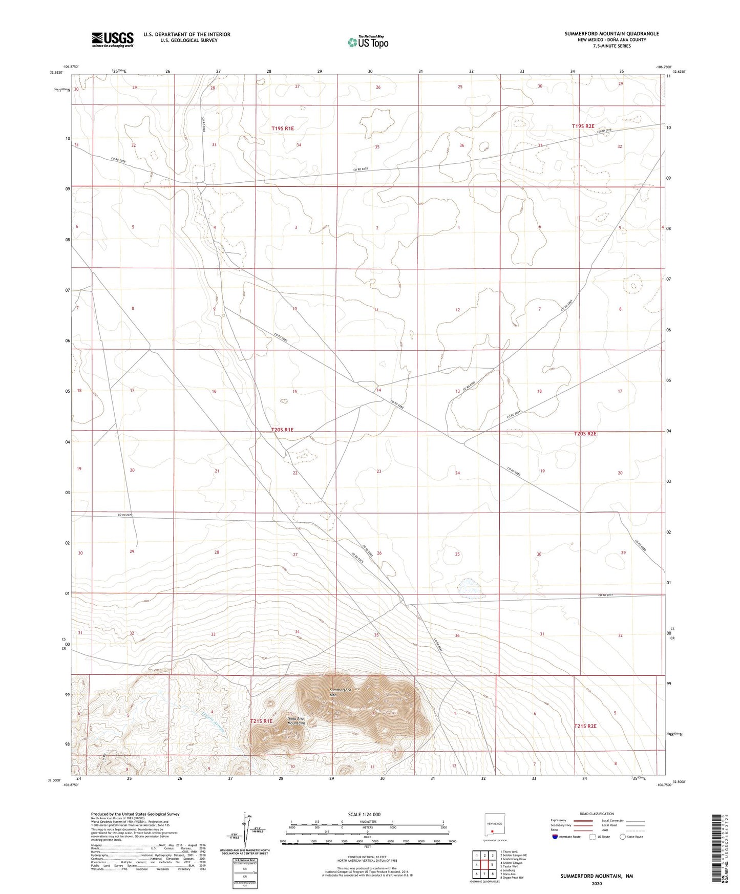
2023 topographic map quadrangle Summerford Mountain in the state of New Mexico. Scale: 1:24000. Based on the newly updated USGS 7.5' US Topo map series, this map is in the following counties: Doña Ana. The map contains contour data, water features, and other items you are used to seeing on USGS maps, but also has updated roads and other features. This is the next generation of topographic maps. Printed on high-quality waterproof paper with UV fade-resistant inks.
Quads adjacent to this one:
West: Selden Canyon
Northwest: Thorn Well
North: Selden Canyon NE
Northeast: Goldenburg Draw
East: Taylor Well
Southeast: Organ Peak NW
South: Dona Ana
Southwest: Leasburg
This map covers the same area as the classic USGS quad with code o32106e7.
Contains the following named places: 10092 Water Well, 88012, Co-op Well, Dona Ana-Hill Division, New Mexico State University Chihuahuan Desert Rangeland Research Center, North Dona Ana Site Dam, State University Ranch Headquarters, Summerford Mountain, West Well