MyTopo
Sierra Alta New Mexico US Topo Map
Couldn't load pickup availability
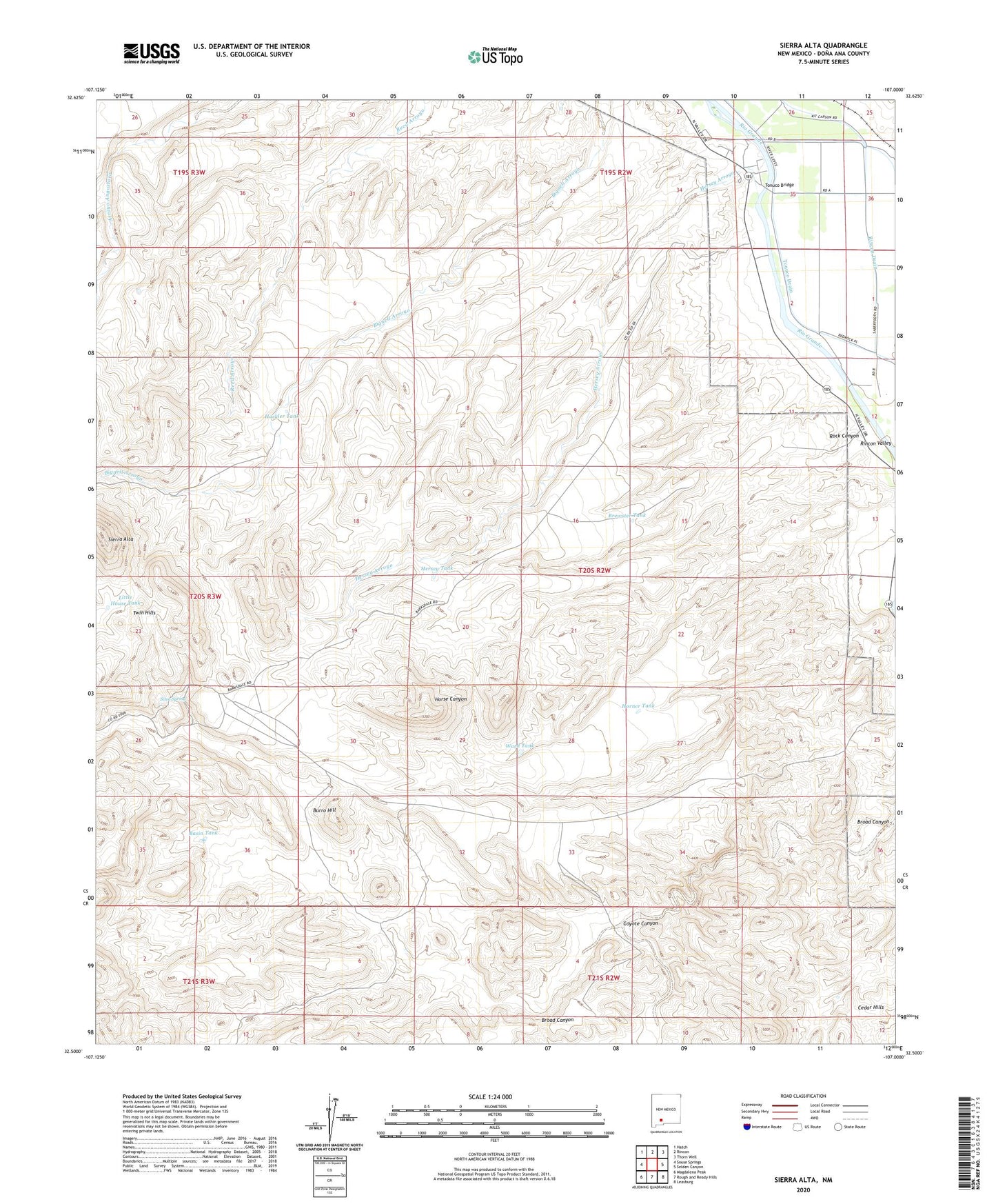
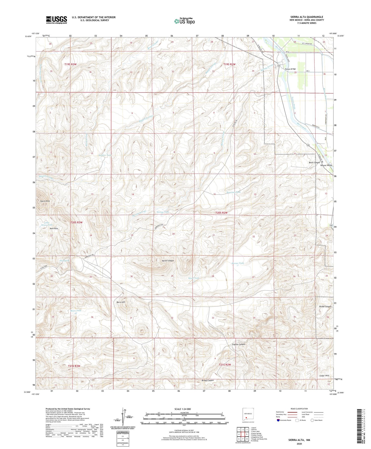
2020 topographic map quadrangle Sierra Alta in the state of New Mexico. Scale: 1:24000. Based on the newly updated USGS 7.5' US Topo map series, this map is in the following counties: Doña Ana. The map contains contour data, water features, and other items you are used to seeing on USGS maps, but also has updated roads and other features. This is the next generation of topographic maps. Printed on high-quality waterproof paper with UV fade-resistant inks.
Quads adjacent to this one:
West: Souse Springs
Northwest: Hatch
North: Rincon
Northeast: Thorn Well
East: Selden Canyon
Southeast: Leasburg
South: Rough and Ready Hills
Southwest: Magdalena Peak
Contains the following named places: 10013 Water Well, 87940, Basin Tank, Brewster Tank, Broad Canyon, Burro Hill, Coyote Canyon, Hackler Tank, Hayner Farm Water Well, Haynor Ranch, Hermantano Springs Ranch, Hersey Arroyo, Hersey Place, Hersey Place Water Well, Hersey Tank, Horner Tank, Kimball Place, Little House Tank, Rock Canyon, Sierra Alta, Sierra Alta Ranch, Sierro Kemado, Silva Spring, Tonuco Bridge, Tonuco Drain, Twin Hills, USBR 6 Water Well, Ward Claims, Ward Number One, Ward Number Two, Ward Tank