MyTopo
Smouse Mesa New Mexico US Topo Map
Couldn't load pickup availability
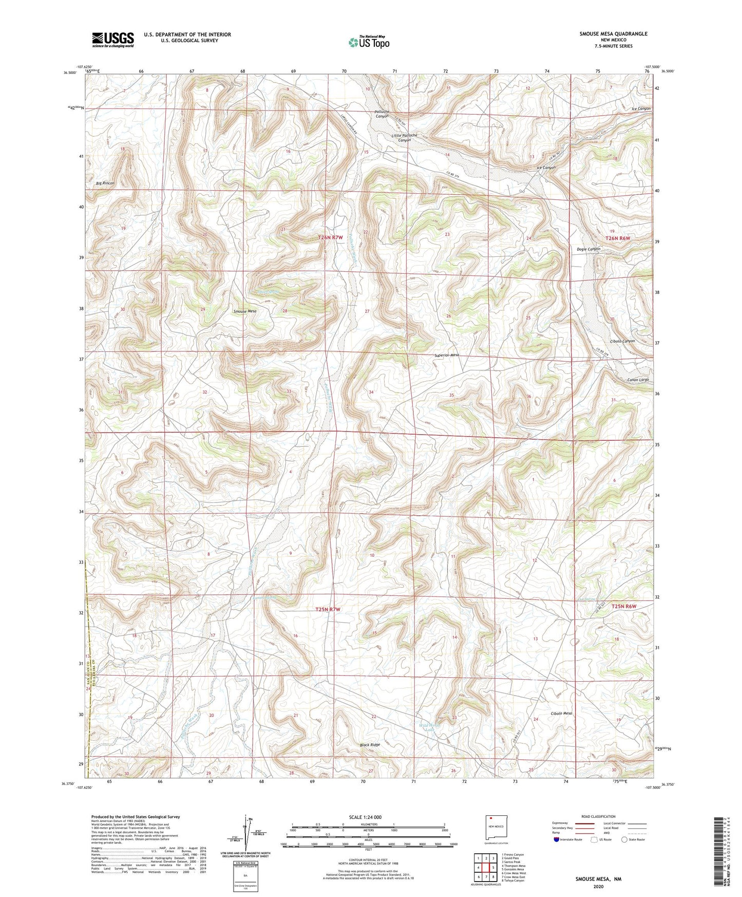
2020 topographic map quadrangle Smouse Mesa in the state of New Mexico. Scale: 1:24000. Based on the newly updated USGS 7.5' US Topo map series, this map is in the following counties: Rio Arriba, San Juan. The map contains contour data, water features, and other items you are used to seeing on USGS maps, but also has updated roads and other features. This is the next generation of topographic maps. Printed on high-quality waterproof paper with UV fade-resistant inks.
Quads adjacent to this one:
West: Thompson Mesa
Northwest: Fresno Canyon
North: Gould Pass
Northeast: Santos Peak
East: Gonzales Mesa
Southeast: Tafoya Canyon
South: Crow Mesa East
Southwest: Crow Mesa West
Contains the following named places: Cibolo Canyon, Cibolo Mesa, Doe Spring, Dogie Canyon, Hooch Spring, Ice Canyon, Largo Camp, Little Palluche Canyon, Palluche Canyon, Palluche Wash, Pinetree Water Well, Romero Spring, Smouse Mesa, Superior Mesa, Truby Ranch, Wild Horse Lake