MyTopo
Solano New Mexico US Topo Map
Couldn't load pickup availability
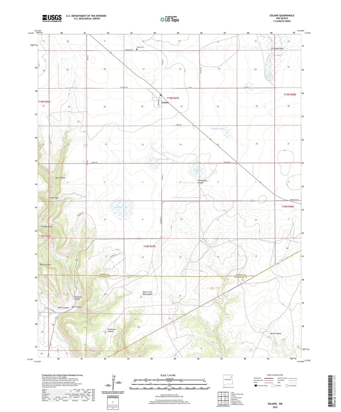
2020 topographic map quadrangle Solano in the state of New Mexico. Scale: 1:24000. Based on the newly updated USGS 7.5' US Topo map series, this map is in the following counties: Harding, San Miguel. The map contains contour data, water features, and other items you are used to seeing on USGS maps, but also has updated roads and other features. This is the next generation of topographic maps. Printed on high-quality waterproof paper with UV fade-resistant inks.
Quads adjacent to this one:
West: La Cinta Canyon
Northwest: Roy
North: Kansas Valley Lake
Northeast: Sabino
East: Mosquero
Southeast: Chinaberry Canyon
South: Waggoner Ranch
Southwest: Montoya Point
Contains the following named places: Barn Point Windmill, Bowmann Windmill, Bradley and Upton, Burro Canyon, Callahan Lake, Canada Bonita, Canon Vigas, Church Lake, Deer Canyon, Goodhue Lake, Harding County Fire District 1 Burro Hill Substation, Harding County Fire District 1 Solano Substation, Heafner, Herton Windmill, Johnson Windmill, La Pompa Draw, Ladd Lake, Leatherman Windmill, McNeil Windmill, Mesa Cortada, Ross Canyon, Seventyfour Windmill, Solano, Solano Cemetery, Solano Post Office, Solano Weather Station, Steinbaugh Windmill, Thompson Canyon, Trujillo Camp, Westfall Lake, ZIP Code: 87746