MyTopo
Sabino New Mexico US Topo Map
Couldn't load pickup availability
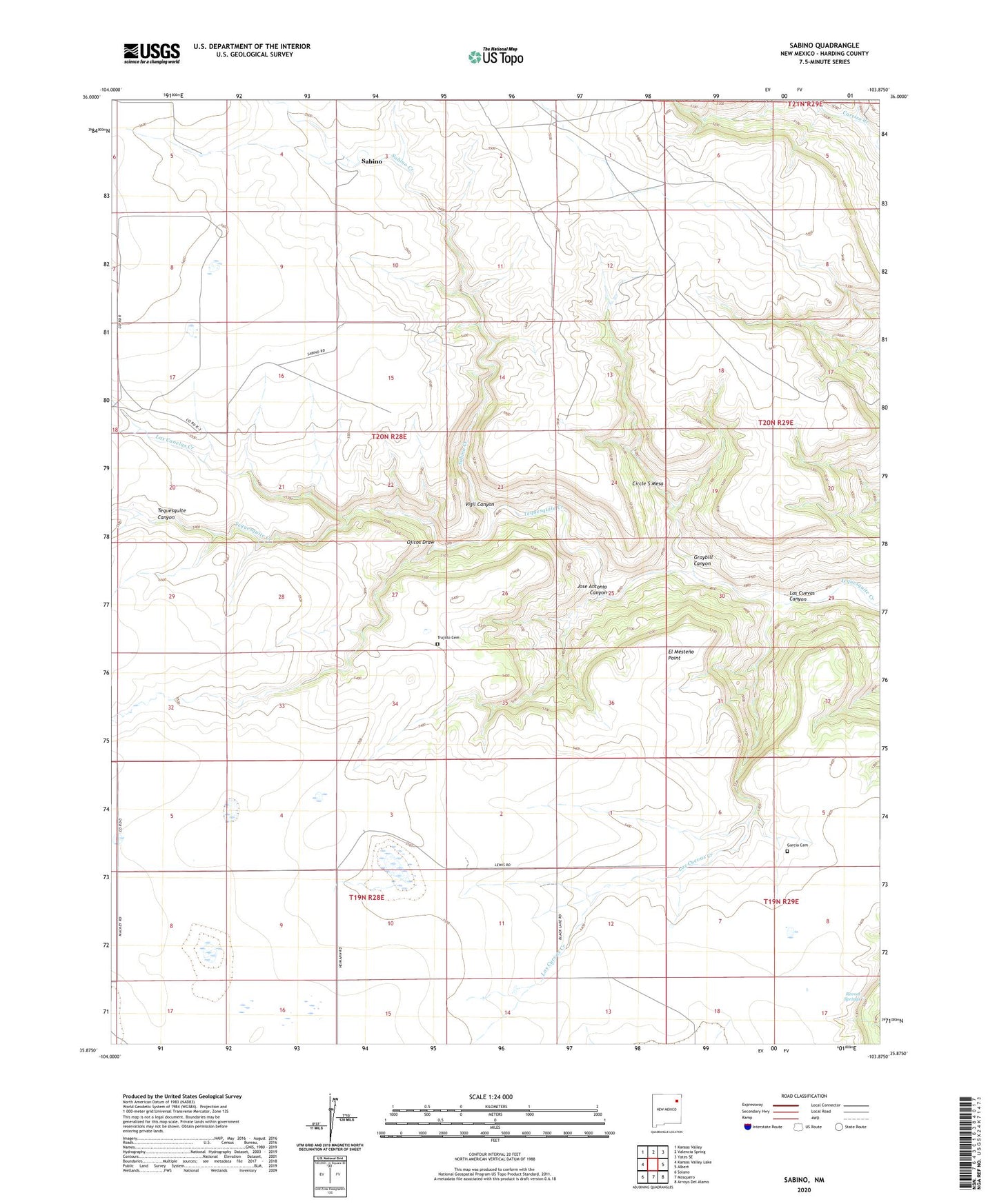
2023 topographic map quadrangle Sabino in the state of New Mexico. Scale: 1:24000. Based on the newly updated USGS 7.5' US Topo map series, this map is in the following counties: Harding. The map contains contour data, water features, and other items you are used to seeing on USGS maps, but also has updated roads and other features. This is the next generation of topographic maps. Printed on high-quality waterproof paper with UV fade-resistant inks.
Quads adjacent to this one:
West: Kansas Valley Lake
Northwest: Kansas Valley
North: Valencia Spring
Northeast: Yates SE
East: Albert
Southeast: Arroyo Del Alamo
South: Mosquero
Southwest: Solano
This map covers the same area as the classic USGS quad with code o35103h8.
Contains the following named places: Circle S Mesa, El Mesteno Point, Garcia Cemetery, Graybill Canyon, Heimann, Jose Antonio Canyon, Las Canelas, Las Canelas Creek, Las Cuevas Canyon, Las Cuevas Creek, Ojitos Draw, Old Sabino Camp, Pat Le Doux Creek, Revoal Springs, Sabino, Sabino Creek, Trujillo Cemetery, Vigil Canyon