MyTopo
Bell Mountain New Mexico US Topo Map
Couldn't load pickup availability
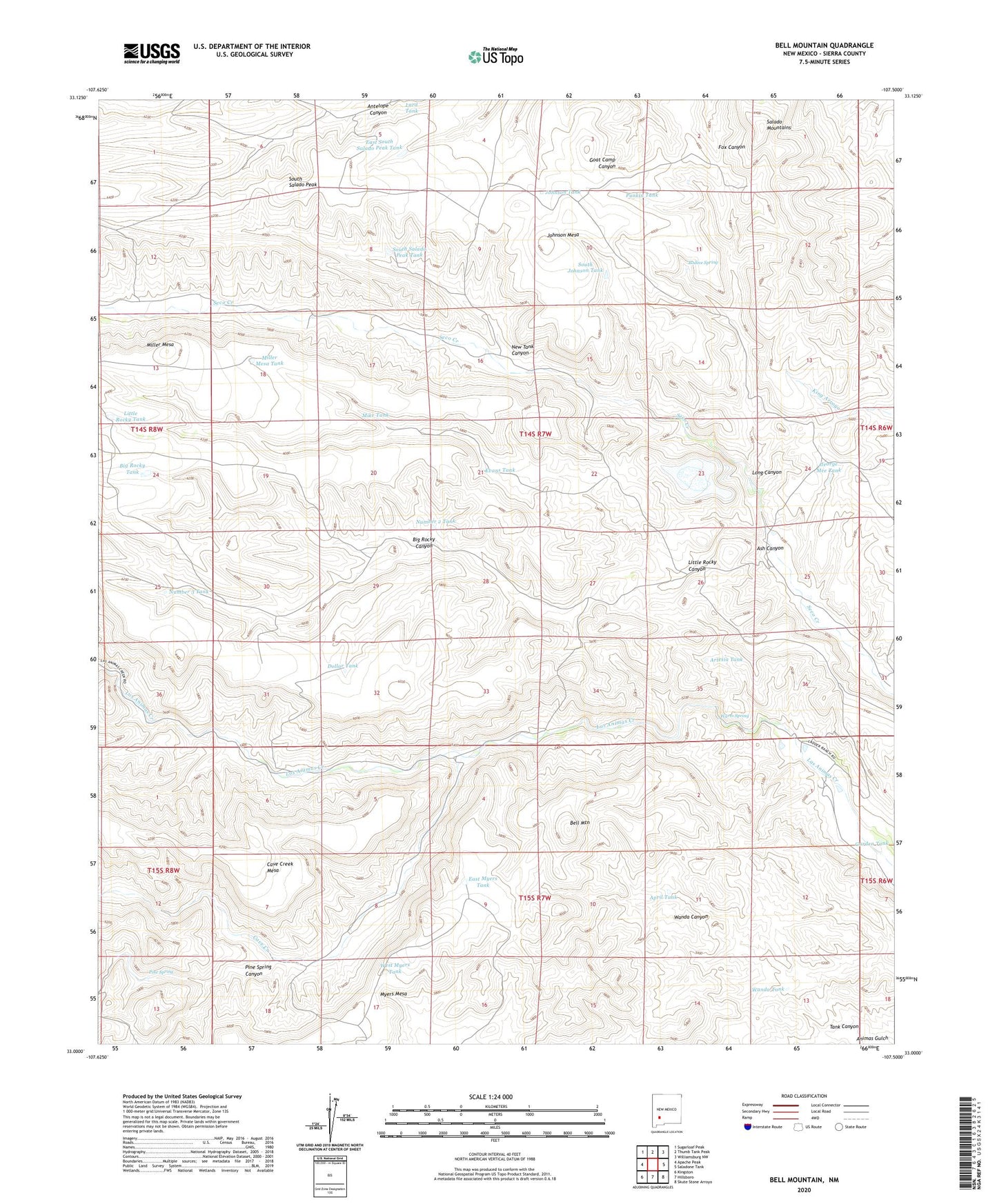
2023 topographic map quadrangle Bell Mountain in the state of New Mexico. Scale: 1:24000. Based on the newly updated USGS 7.5' US Topo map series, this map is in the following counties: Sierra. The map contains contour data, water features, and other items you are used to seeing on USGS maps, but also has updated roads and other features. This is the next generation of topographic maps. Printed on high-quality waterproof paper with UV fade-resistant inks.
Quads adjacent to this one:
West: Apache Peak
Northwest: Sugarloaf Peak
North: Thumb Tank Peak
Northeast: Williamsburg NW
East: Saladone Tank
Southeast: Skute Stone Arroyo
South: Hillsboro
Southwest: Kingston
This map covers the same area as the classic USGS quad with code o33107a5.
Contains the following named places: Antelope Windmill, April Tank, Artesia Tank, Artesia Windmill, Ash Canyon, Bell Mountain, Big Rocky Canyon, Big Rocky Tank, Bodine Spring, Cave Creek, Cave Creek Mesa, Crews Well, Dollar Tank, East Myers Tank, East South Salado Peak Tank, Evans Tank, Fish Well, Fox Tank, Francisco Rascon Place, Garden Tank, George Mee Tank, George Mee Windmill, Higgins Well, Johnson Mesa, Johnson Tank, Johnson Windmill, Ladder Ranch, Little Rocky Canyon, Little Rocky Tank, Long Canyon, Mike Tank, Miller Mesa, Miller Mesa Tank, Myers Mesa, New Tank Canyon, Number 2 Tank, Number 2 Windmill, Number 3 Tank, Number 3 Windmill, Pine Spring, Pine Spring Canyon, Punkin Tank, Salado Mountains, Salado Mountains Fluorspar Deposit, South Hill, South Johnson Tank, South Salado Peak, South Salado Peak Tank, Tank Canyon, Truth or Consequences West Division, Wanda Tank, Wanda Well, Warm Spring, West Myers Tank