MyTopo
Tres Lagunas New Mexico US Topo Map
Couldn't load pickup availability
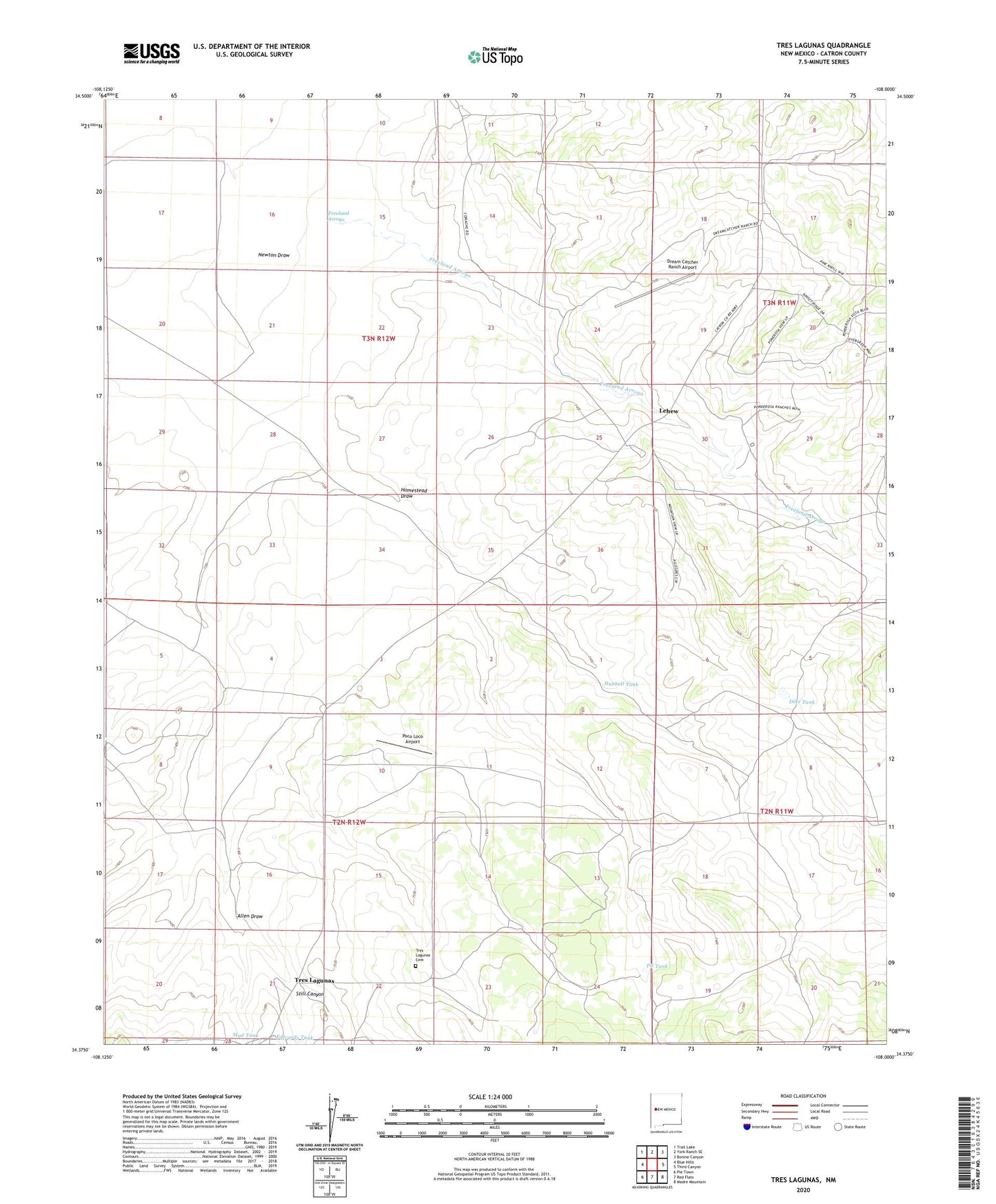
2023 topographic map quadrangle Tres Lagunas in the state of New Mexico. Scale: 1:24000. Based on the newly updated USGS 7.5' US Topo map series, this map is in the following counties: Catron. The map contains contour data, water features, and other items you are used to seeing on USGS maps, but also has updated roads and other features. This is the next generation of topographic maps. Printed on high-quality waterproof paper with UV fade-resistant inks.
Quads adjacent to this one:
West: Blue Hills
Northwest: Trail Lake
North: York Ranch SE
Northeast: Bonine Canyon
East: Third Canyon
Southeast: Madre Mountain
South: Red Flats
Southwest: Pie Town
This map covers the same area as the classic USGS quad with code o34108d1.
Contains the following named places: Allen Draw, Bones Well, Bumpass, Dike Tank, Dream Catcher Ranch Airport, Duggins Well, Edwards Tank, Freeland Arroyo, Homestead Draw, Hubbell Tank, Lehew, Lehew Ranch, Mud Tank, Newton Draw, Newton Well, North Hubbell Well, Perry Well, Pit Tank, Poco Loco Airport, Schoolhouse Tank, Still Canyon, Stuart Station Well, Stuart Well, Tres Lagunas, Tres Lagunas Cemetery, Tres Lagunas Post Office, Veteado Camp, West Hubbell Well, ZIP Code: 87827