MyTopo
Pie Town New Mexico US Topo Map
Couldn't load pickup availability
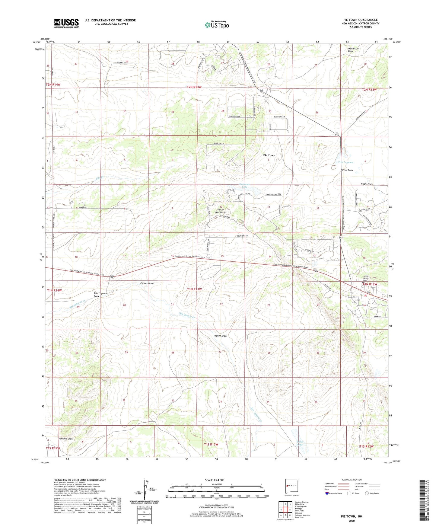
2023 topographic map quadrangle Pie Town in the state of New Mexico. Scale: 1:24000. Based on the newly updated USGS 7.5' US Topo map series, this map is in the following counties: Catron. The map contains contour data, water features, and other items you are used to seeing on USGS maps, but also has updated roads and other features. This is the next generation of topographic maps. Printed on high-quality waterproof paper with UV fade-resistant inks.
Quads adjacent to this one:
West: Omega
Northwest: Adams Diggings
North: Blue Hills
Northeast: Tres Lagunas
East: Red Flats
Southeast: Cox Peak
South: Alegres Mountain
Southwest: Mangas
This map covers the same area as the classic USGS quad with code o34108c2.
Contains the following named places: Bols Well, Bull Pasture Well, Chamiso Well, Chavez Draw, Electric Well, First Baptist Church, Haynes, Juniper Haven Cemetery, Lake Well, Long Lake, Long Lake Well, McKee, Nalda Ranch Airport, North Well, Odyssey School, Pancake Draw, Payne Draw, Pie Town, Pie Town Census Designated Place, Pie Town Emergency Medical Services, Pie Town Post Office, Pie Town Volunteer Fire Department, Rigsby, Santianez Lake, Seeps Well, Tingle Flats, Toms Rock Pueblo, Top of the World, Tres Lagunas, Tres Lagunas Draw, Upper Well, Wade Well, Wyche Draw