MyTopo
Red Flats New Mexico US Topo Map
Couldn't load pickup availability
Also explore the Red Flats Forest Service Topo of this same quad for updated USFS data
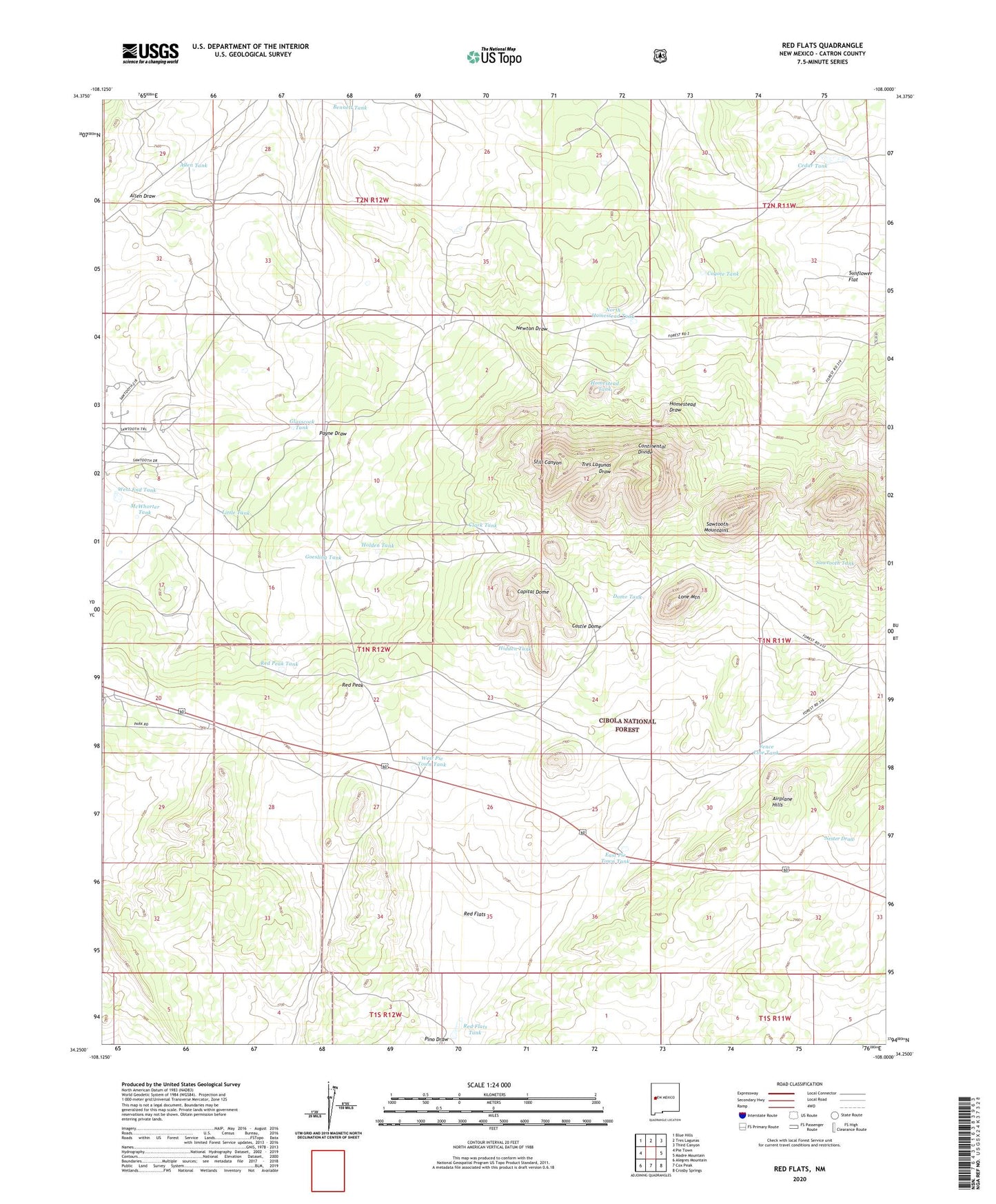
2023 topographic map quadrangle Red Flats in the state of New Mexico. Scale: 1:24000. Based on the newly updated USGS 7.5' US Topo map series, this map is in the following counties: Catron. The map contains contour data, water features, and other items you are used to seeing on USGS maps, but also has updated roads and other features. This is the next generation of topographic maps. Printed on high-quality waterproof paper with UV fade-resistant inks.
Quads adjacent to this one:
West: Pie Town
Northwest: Blue Hills
North: Tres Lagunas
Northeast: Third Canyon
East: Madre Mountain
Southeast: Crosby Springs
South: Cox Peak
Southwest: Alegres Mountain
This map covers the same area as the classic USGS quad with code o34108c1.
Contains the following named places: Airplane Hills, Allen Tank, Bennett Tank, Brasier Tank, Capital Dome, Castle Dome, Cedar Tank, Clark Tank, Coyote Tank, Dome Tank, East Pie Town Tank, Fence Line Tank, Glasscock Tank, Goesling Tank, Hidden Tank, Holden Tank, Homestead Tank, Little Tank, Lone Mountain, McWhorter Tank, North Forest Well, North Homestead Tank, Pino Draw, Red Flats, Red Flats Tank, Red Peak, Red Peak Tank, Sawtooth Tank, Sunflower Flat, West End Tank, West Pie Town Tank, West Sawtooth Well