MyTopo
Tub Spring New Mexico US Topo Map
Couldn't load pickup availability
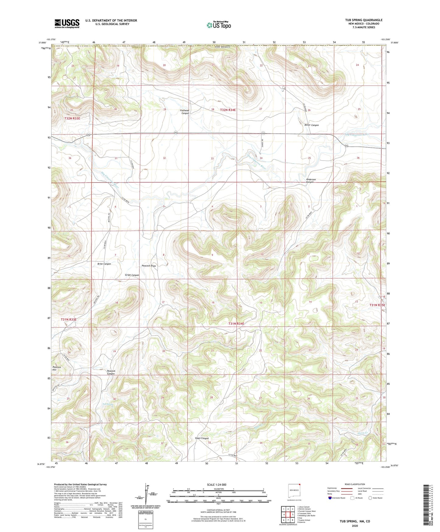
2023 topographic map quadrangle Tub Spring in the state of New Mexico. Scale: 1:24000. Based on the newly updated USGS 7.5' US Topo map series, this map is in the following counties: Union, Las Animas. The map contains contour data, water features, and other items you are used to seeing on USGS maps, but also has updated roads and other features. This is the next generation of topographic maps. Printed on high-quality waterproof paper with UV fade-resistant inks.
Quads adjacent to this one:
West: Travesser Park
Northwest: Jesus Canyon
North: Dennis Canyon
Northeast: Furnish Canyon West
East: Wedding Cake Butte
Southeast: Atencio
South: Cuates School
Southwest: Guy
This map covers the same area as the classic USGS quad with code o36103h3.
Contains the following named places: Anderson Canyon, Bechtel, Brite Canyon, Farr, Flathead Canyon, Gregory Well, Gripe Canyon, Miller Canyon, North Young Pocket Well, Peacock Canyon, Peacock Canyon Prospects, Peacock Draw, Peacock Hill, South Young Pocket Well, Tub Spring