MyTopo
Gallo Mountains East New Mexico US Topo Map
Couldn't load pickup availability
Also explore the Gallo Mountains East Forest Service Topo of this same quad for updated USFS data
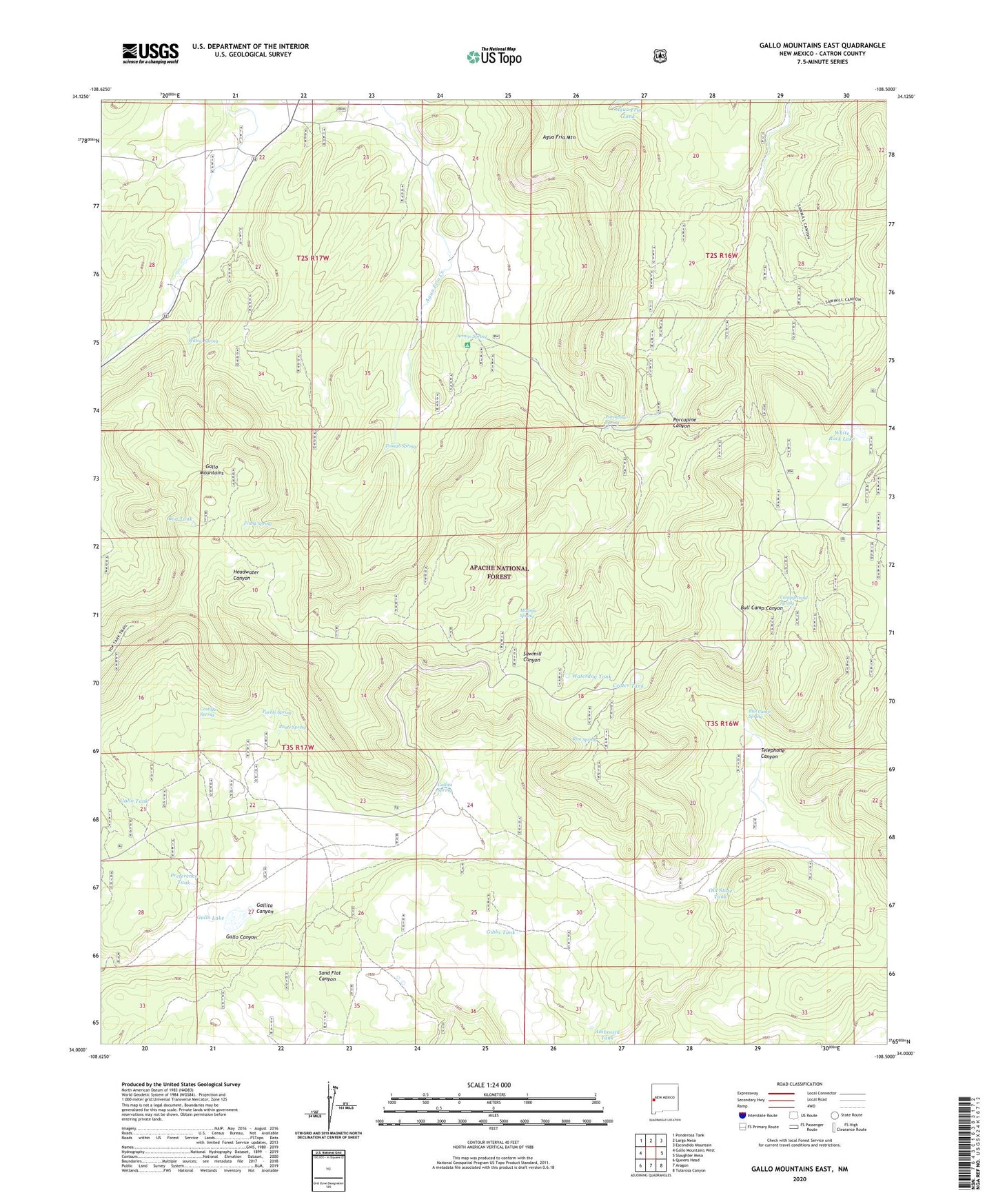
2023 topographic map quadrangle Gallo Mountains East in the state of New Mexico. Scale: 1:24000. Based on the newly updated USGS 7.5' US Topo map series, this map is in the following counties: Catron. The map contains contour data, water features, and other items you are used to seeing on USGS maps, but also has updated roads and other features. This is the next generation of topographic maps. Printed on high-quality waterproof paper with UV fade-resistant inks.
Quads adjacent to this one:
West: Gallo Mountains West
Northwest: Ponderosa Tank
North: Largo Mesa
Northeast: Escondido Mountain
East: Slaughter Mesa
Southeast: Tularosa Canyon
South: Aragon
Southwest: Queens Head
This map covers the same area as the classic USGS quad with code o34108a5.
Contains the following named places: Acorn Tank, Agua Fria Tank, Ambrosia Tank, Armijo Campground, Armijo Spring, Armijo Tank, Bog Tank, Bull Camp, Bull Camp Pit Tank, Bull Camp Spring, Campground Spring, Costilla Spring, Crater Tank, Davis Windmill, East Tank, First Windmill, Frank Spring, Gallita Canyon, Gallita Spring, Gallo Lake, Gallo Mountains, Gallo Tank, Gibbs Tank, Harris Canyon, Hog Back Pit Tank, Hook Tank, Malpais Spring, Old State Tank, Porcupine Canyon, Porcupine Spring, Preference Tank, Pueblo Spring, Rim Spring, Road Tanks, Route Spring, Sawmill Camp Trail, Sawmill Windmill, Shallow Tank, Telephone Canyon, Telephone Tank, Trough Spring, Tule Lake, Waterdog Tank, White Rock Lake, Willow Creek, Willow Spring, Windy Tank