MyTopo
Tularosa NE New Mexico US Topo Map
Couldn't load pickup availability
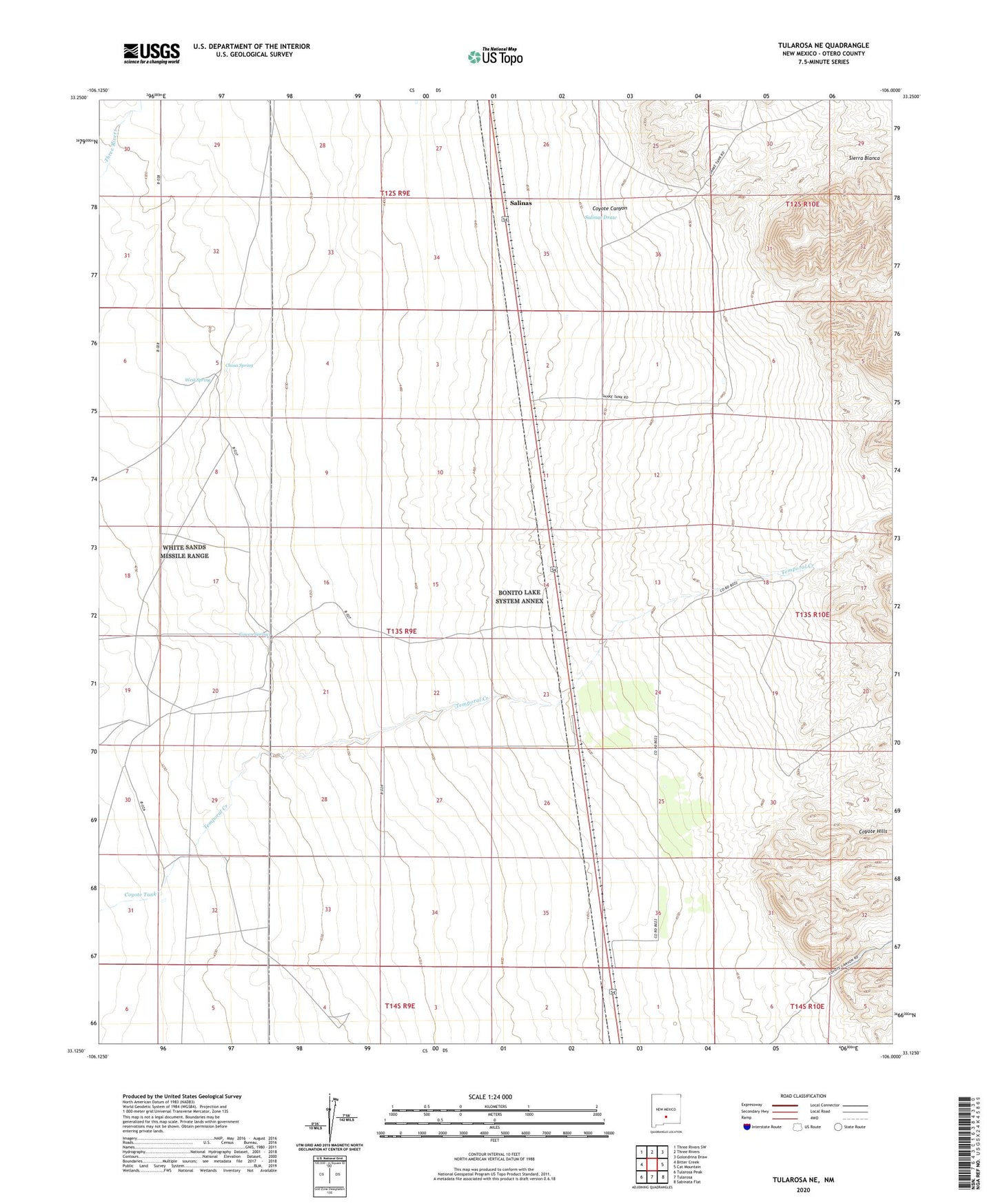
2023 topographic map quadrangle Tularosa NE in the state of New Mexico. Scale: 1:24000. Based on the newly updated USGS 7.5' US Topo map series, this map is in the following counties: Otero. The map contains contour data, water features, and other items you are used to seeing on USGS maps, but also has updated roads and other features. This is the next generation of topographic maps. Printed on high-quality waterproof paper with UV fade-resistant inks.
Quads adjacent to this one:
West: Bitter Creek
Northwest: Three Rivers SW
North: Three Rivers
Northeast: Golondrina Draw
East: Cat Mountain
Southeast: Sabinata Flat
South: Tularosa
Southwest: Tularosa Peak
This map covers the same area as the classic USGS quad with code o33106b1.
Contains the following named places: Chosa Ranch, Chosa Spring, Cowen Spring, Coyote Canyon, Coyote Hills, Coyote Tank, Crosby Windmill, Lower Snake Tank, Middle Well, New Well, Salinas, Salinas Draw, Salinas Post Office, Snake Tank, Stover Ranch, Temporal, Temporal Creek, Temporal Well, Tularosa Division, Turner Well, West Spring, West Tank