MyTopo
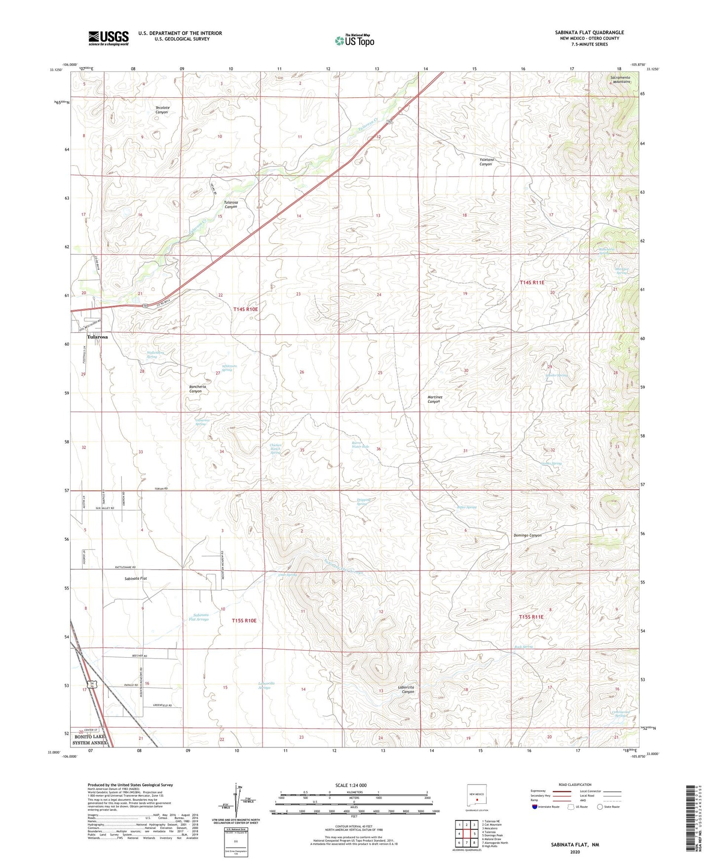
Sabinata Flat New Mexico US Topo Map
Couldn't load pickup availability
2023 topographic map quadrangle Sabinata Flat in the state of New Mexico. Scale: 1:24000. Based on the newly updated USGS 7.5' US Topo map series, this map is in the following counties: Otero. The map contains contour data, water features, and other items you are used to seeing on USGS maps, but also has updated roads and other features. This is the next generation of topographic maps. Printed on high-quality waterproof paper with UV fade-resistant inks.
Quads adjacent to this one:
West: Tularosa
Northwest: Tularosa NE
North: Cat Mountain
Northeast: Mescalero
East: Domingo Peak
Southeast: High Rolls
South: Alamogordo North
Southwest: Malone Draw
This map covers the same area as the classic USGS quad with code o33105a8.
Contains the following named places: 10026 Water Well, 10628 Water Well, Alamorosa, Armstrong and Armstrong Rock, Bitter Spring, Burro Water Hole, Chicken Ranch Spring, Cottonwood Canyon, Domingo Canyon, Dripping Spring, Gomez Spring, Gutierrez Spring, Hunter Spring, Laborcita Canyon, Martinez Canyon, Martinez Spring, Mitchell Dam, Rancheria Canyon, Rancheria Spring, Red Tank, Rock Spring, Sabinata Flat, Sabinata Flat Arroyo, School Section Windmill, Tularosa Canyon, Utter Spring, Wallenberg Spring, Whitmore Spring, Ysletano Canyon