MyTopo
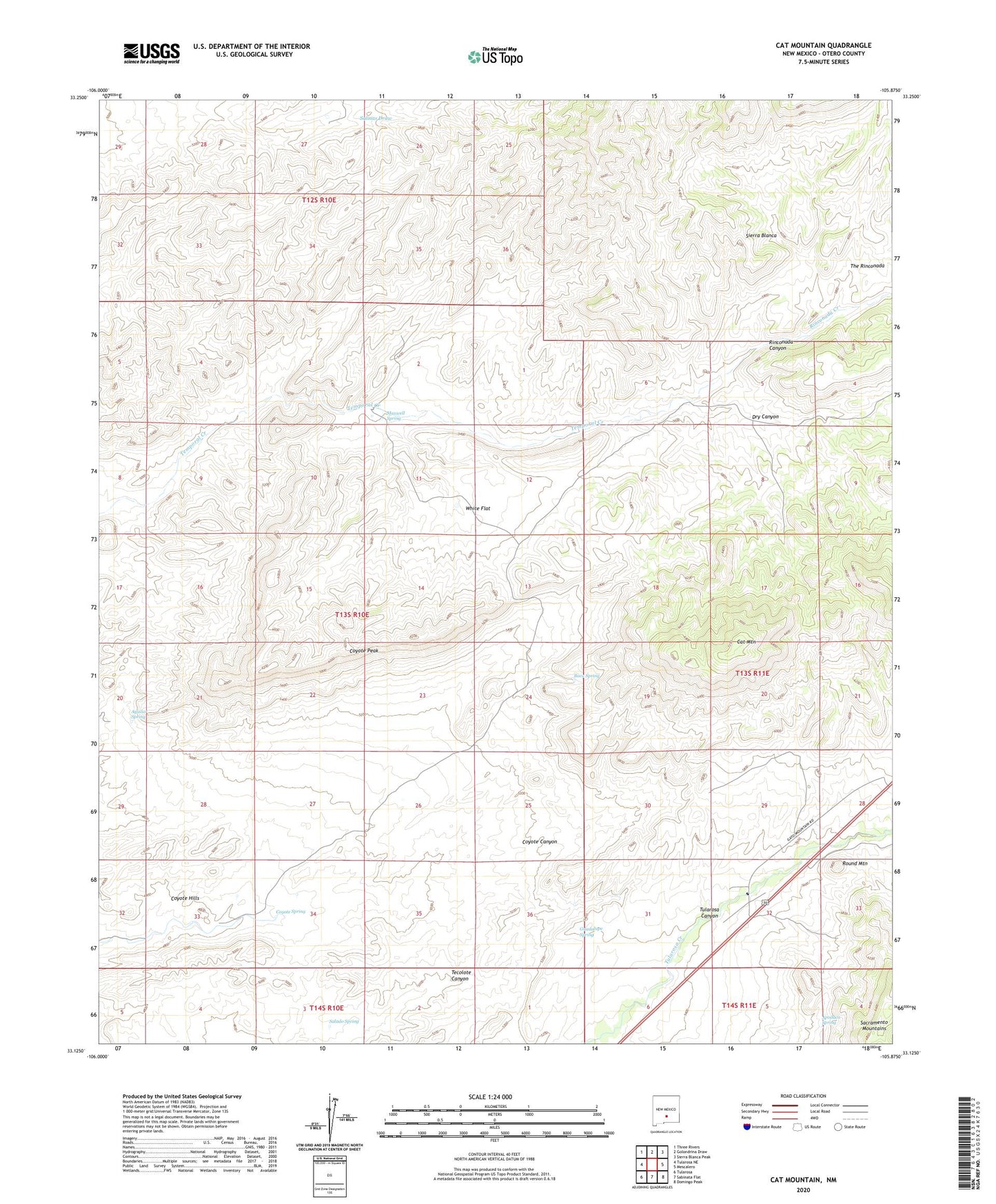
Cat Mountain New Mexico US Topo Map
Couldn't load pickup availability
2023 topographic map quadrangle Cat Mountain in the state of New Mexico. Scale: 1:24000. Based on the newly updated USGS 7.5' US Topo map series, this map is in the following counties: Otero. The map contains contour data, water features, and other items you are used to seeing on USGS maps, but also has updated roads and other features. This is the next generation of topographic maps. Printed on high-quality waterproof paper with UV fade-resistant inks.
Quads adjacent to this one:
West: Tularosa NE
Northwest: Three Rivers
North: Golondrina Draw
Northeast: Sierra Blanca Peak
East: Mescalero
Southeast: Domingo Peak
South: Sabinata Flat
Southwest: Tularosa
This map covers the same area as the classic USGS quad with code o33105b8.
Contains the following named places: Aguilar Spring, Apodaca Spring, Baca Spring, Buck Camp, Cat Mountain, Coyote Peak, Coyote Spring, Coyote Well, Dry Canyon, Granite Well, Guadalupe Spring, Gyp Well, Iron Rock Well, KPSA-FM (Alamogordo), Maxwell Spring, Rinconada Canyon, Rinconada Creek, Round Mountain, Round Mountain Historical Marker, Salado Spring, White Flat, White Flat Tank, ZIP Code: 88352