MyTopo
Vermejo Park New Mexico US Topo Map
Couldn't load pickup availability
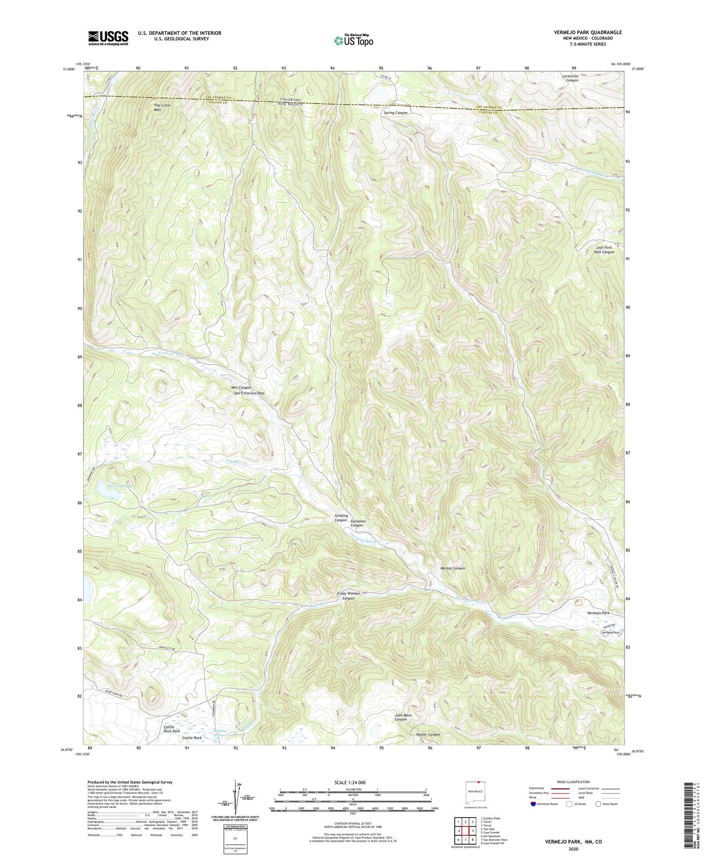
2020 topographic map quadrangle Vermejo Park in the states of New Mexico, Colorado. Scale: 1:24000. Based on the newly updated USGS 7.5' US Topo map series, this map is in the following counties: Colfax, Las Animas. The map contains contour data, water features, and other items you are used to seeing on USGS maps, but also has updated roads and other features. This is the next generation of topographic maps. Printed on high-quality waterproof paper with UV fade-resistant inks.
Quads adjacent to this one:
West: The Wall
Northwest: Culebra Peak
North: Torres
Northeast: Tercio
East: Casa Grande
Southeast: Casa Grande SW
South: Van Bremmer Park
Southwest: Ash Mountain
Contains the following named places: Bartlett Mine, Bernal Creek, Bubbling Springs, Castle Rock, Castle Rock Park, Crazy Woman Canyon, Gonzales Canyon, Leandro Creek, Merrick Lake, Mestas Canyon, Rock Creek, San Francisco Pass, Stinking Canyon, Vasquez Camp, Vermejo Park, Wet Canyon