MyTopo
Walnut Wells NE New Mexico US Topo Map
Couldn't load pickup availability
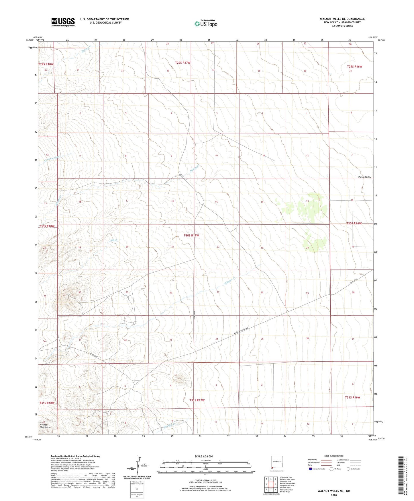
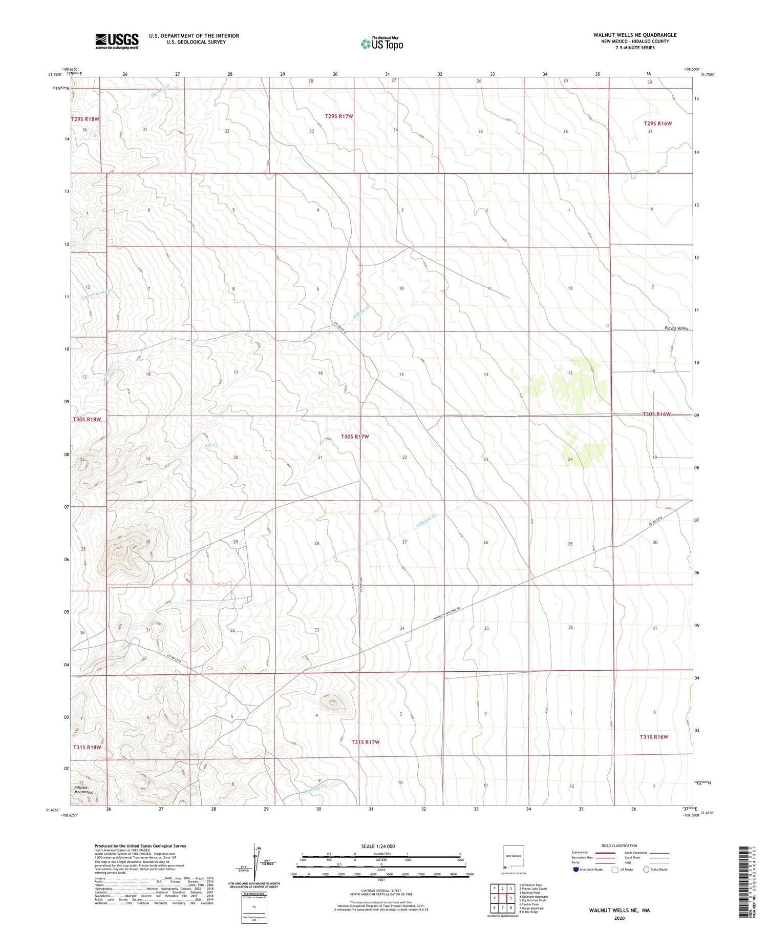
2020 topographic map quadrangle Walnut Wells NE in the state of New Mexico. Scale: 1:24000. Based on the newly updated USGS 7.5' US Topo map series, this map is in the following counties: Hidalgo. The map contains contour data, water features, and other items you are used to seeing on USGS maps, but also has updated roads and other features. This is the next generation of topographic maps. Printed on high-quality waterproof paper with UV fade-resistant inks.
Quads adjacent to this one:
West: Gillespie Mountain
Northwest: Whitmire Pass
North: Playas Lake South
Northeast: Hachita Peak
East: Big Hatchet Peak
Southeast: U Bar Ridge
South: Horse Mountain
Southwest: Center Peak
Contains the following named places: 10350 Water Well, Ash Creek, Bennett Creek, Cottonwood Creek, Cowboy Creek, Darling Creek, Gillespie Creek, Jacks Defeat, Lanes Ranch, Millsite Creek, Red Hill Mine, Youngs Ranch