
MyTopo
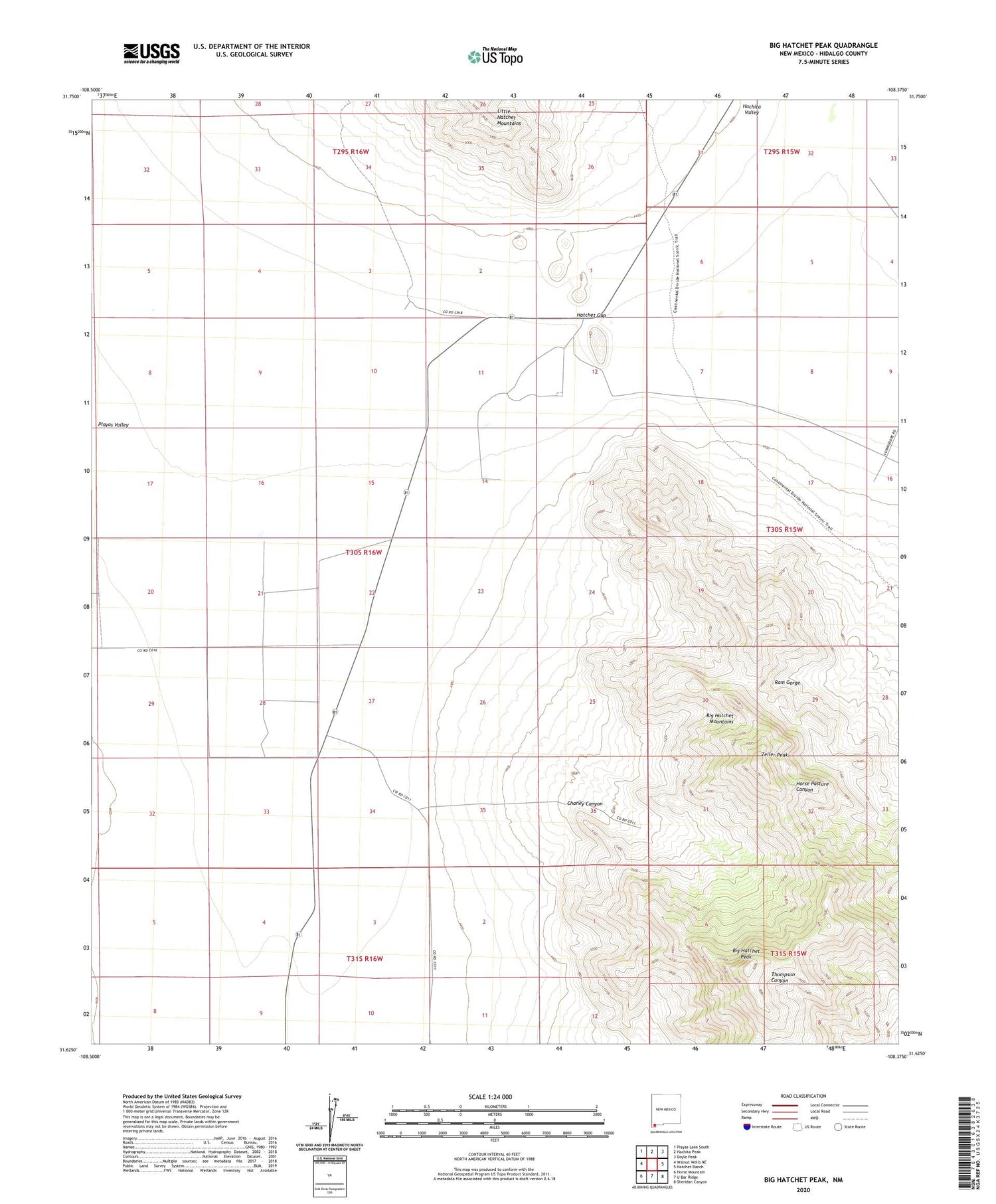
Big Hatchet Peak New Mexico US Topo Map
Couldn't load pickup availability
2023 topographic map quadrangle Big Hatchet Peak in the state of New Mexico. Scale: 1:24000. Based on the newly updated USGS 7.5' US Topo map series, this map is in the following counties: Hidalgo. The map contains contour data, water features, and other items you are used to seeing on USGS maps, but also has updated roads and other features. This is the next generation of topographic maps. Printed on high-quality waterproof paper with UV fade-resistant inks.
Quads adjacent to this one:
West: Walnut Wells NE
Northwest: Playas Lake South
North: Hachita Peak
Northeast: Doyle Peak
East: Hatchet Ranch
Southeast: Sheridan Canyon
South: U Bar Ridge
Southwest: Horse Mountain
This map covers the same area as the classic USGS quad with code o31108f4.
Contains the following named places: Benton Ranch, Big Hatchet Mountains Wilderness Study Area, Big Hatchet Peak, Boone Ranch, Chaineys Ranch, Chaney Canyon, Hatchet Gap, Lambert Ranch, Old Hatchet Ranch, Parkers Ranch, Petersons Ranch, Upshaw Ranch, Worthington Ranch, Zeller Peak


