
MyTopo
Watts Hill New Mexico US Topo Map
Couldn't load pickup availability
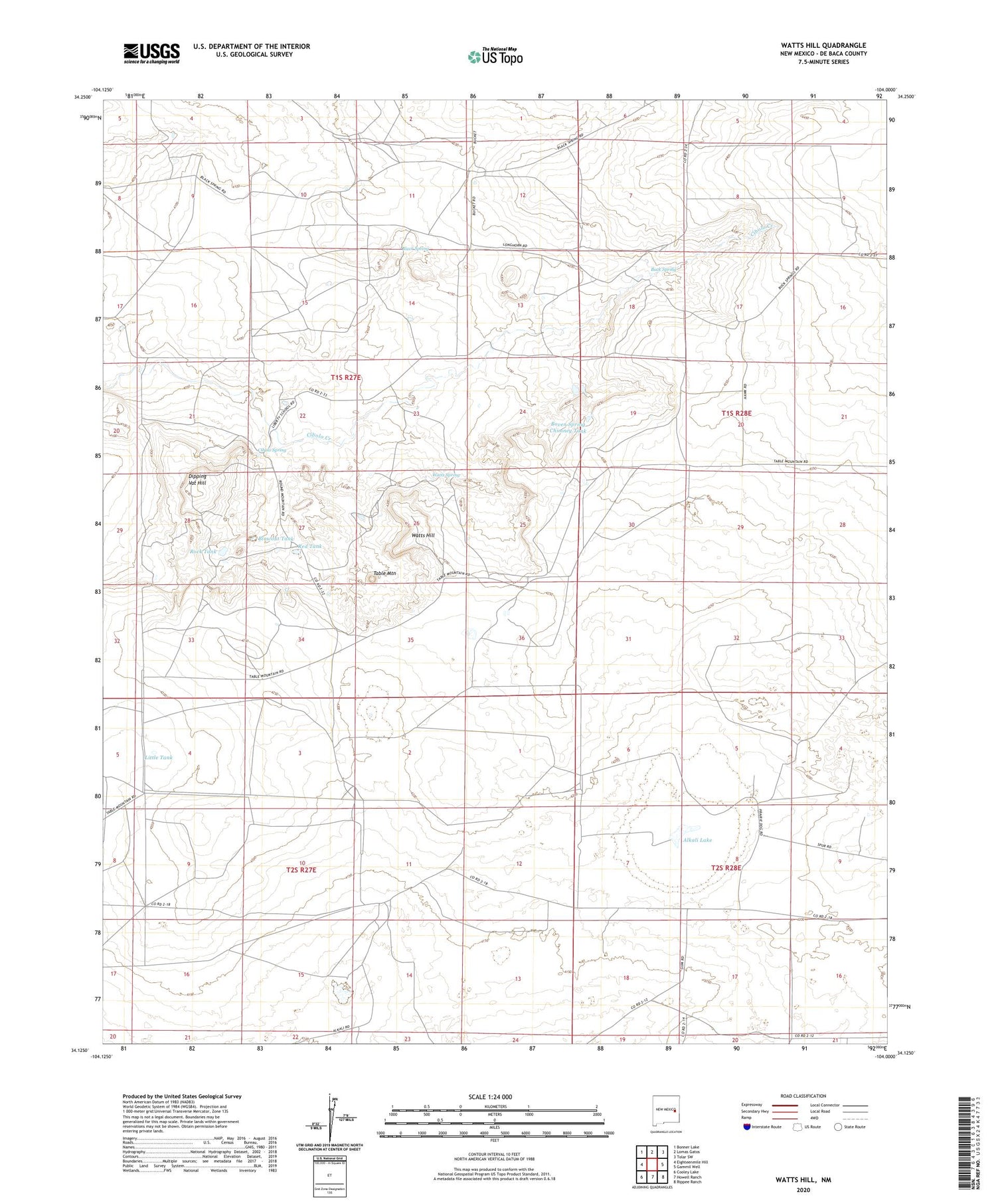
2020 topographic map quadrangle Watts Hill in the state of New Mexico. Scale: 1:24000. Based on the newly updated USGS 7.5' US Topo map series, this map is in the following counties: De Baca. The map contains contour data, water features, and other items you are used to seeing on USGS maps, but also has updated roads and other features. This is the next generation of topographic maps. Printed on high-quality waterproof paper with UV fade-resistant inks.
Quads adjacent to this one:
West: Eighteenmile Hill
Northwest: Bonner Lake
North: Lomas Gatos
Northeast: Tolar SW
East: Gammil Well
Southeast: Rippee Ranch
South: Howell Ranch
Southwest: Cooley Lake
Contains the following named places: Alkali Lake, Black Spring, Blowout Tank, Boven Spring Chimney Tank, Buck Spring, Butts Windmill, Canton, Canton Post Office, Canton School, Canton Weather Station, Carroll Windmill, Cibolo Spring, Clure Windmill, Colter Ranch, Dipping Vat Hill, Jointer Windmill, Jones Camp, Jones Windmill, Liberty School, Little Red Windmill, Little Tank, North Windmill, Payne Windmill, Red Tank, Rock Tank, Shoemake Windmill, Soda Windmill, Table Mountain, Watts Hill, Watts Spring, Wharton Windmill


