MyTopo
Wedding Cake Butte New Mexico US Topo Map
Couldn't load pickup availability
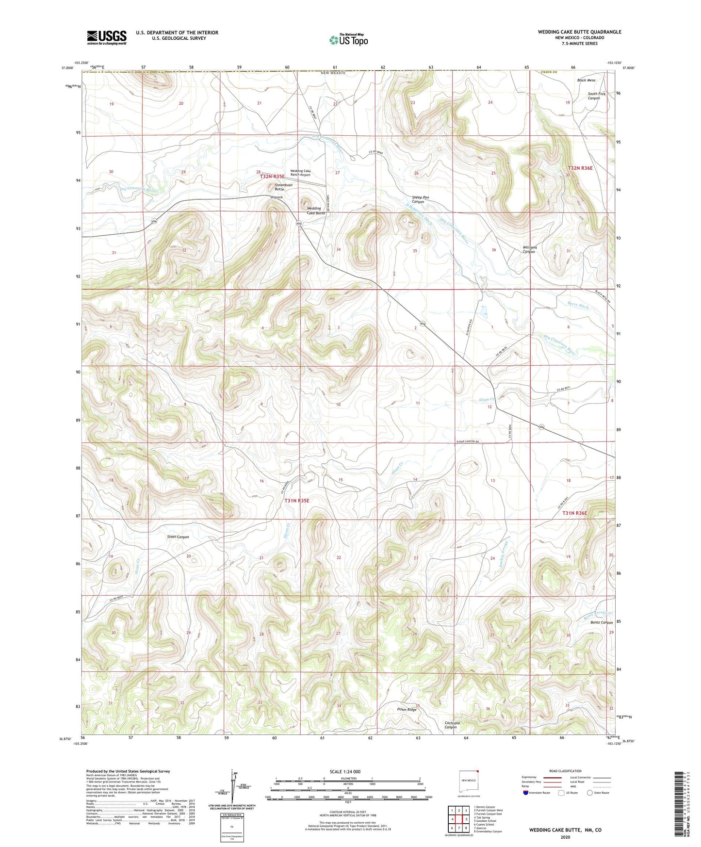
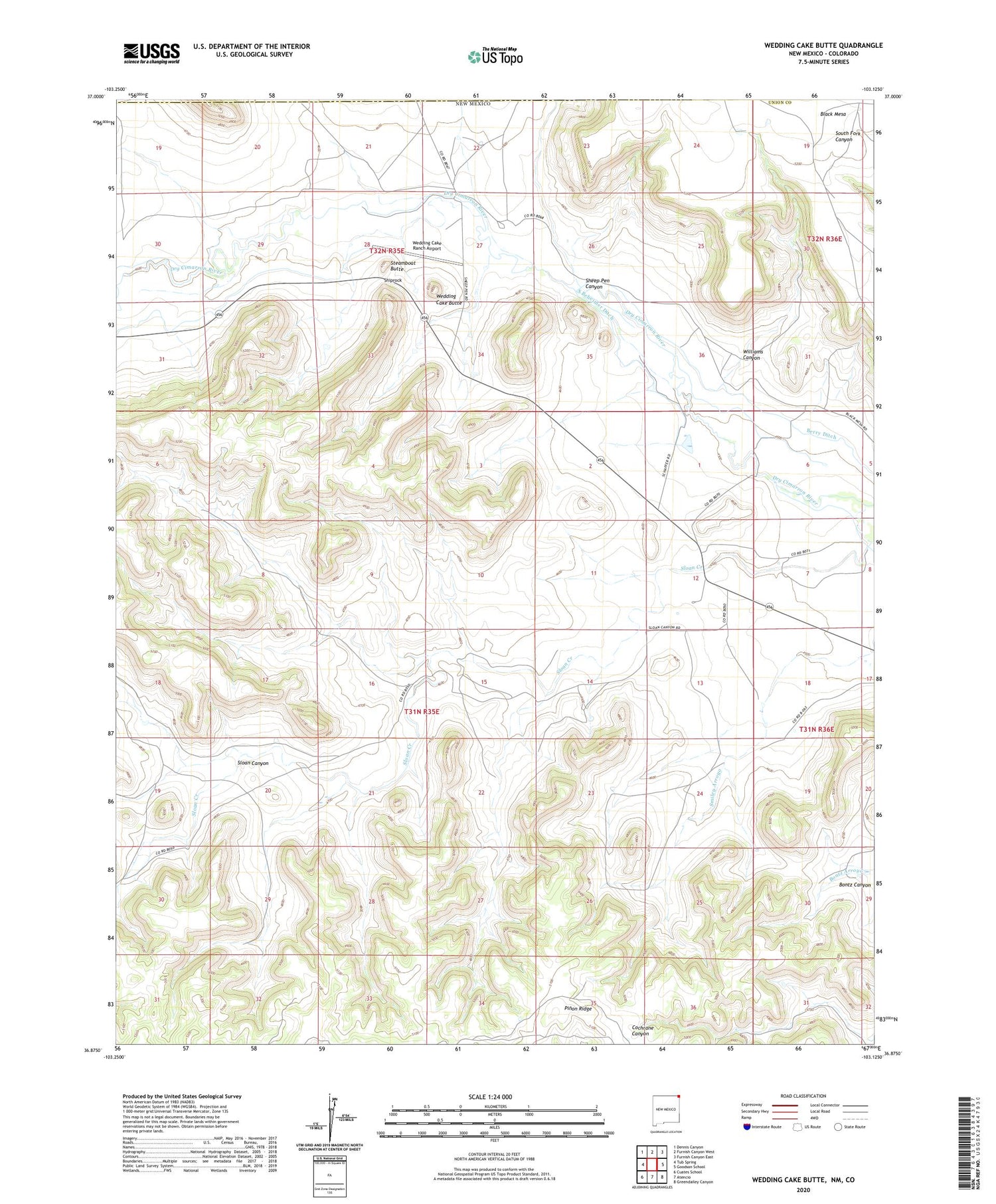
2020 topographic map quadrangle Wedding Cake Butte in the state of New Mexico. Scale: 1:24000. Based on the newly updated USGS 7.5' US Topo map series, this map is in the following counties: Union, Las Animas. The map contains contour data, water features, and other items you are used to seeing on USGS maps, but also has updated roads and other features. This is the next generation of topographic maps. Printed on high-quality waterproof paper with UV fade-resistant inks.
Quads adjacent to this one:
West: Tub Spring
Northwest: Dennis Canyon
North: Furnish Canyon West
Northeast: Furnish Canyon East
East: Goodson School
Southeast: Greendailey Canyon
South: Atencio
Southwest: Cuates School
Contains the following named places: Berry Ditch, Bontz Canyon, Heyen, Pinon Ridge, Sheep Pen Canyon, Shiprock, Sloan Canyon, South Beheimer Ditch, Steamboat Butte, Wedding Cake Butte, Wedding Cake Ranch Airport, Williams Canyon