MyTopo
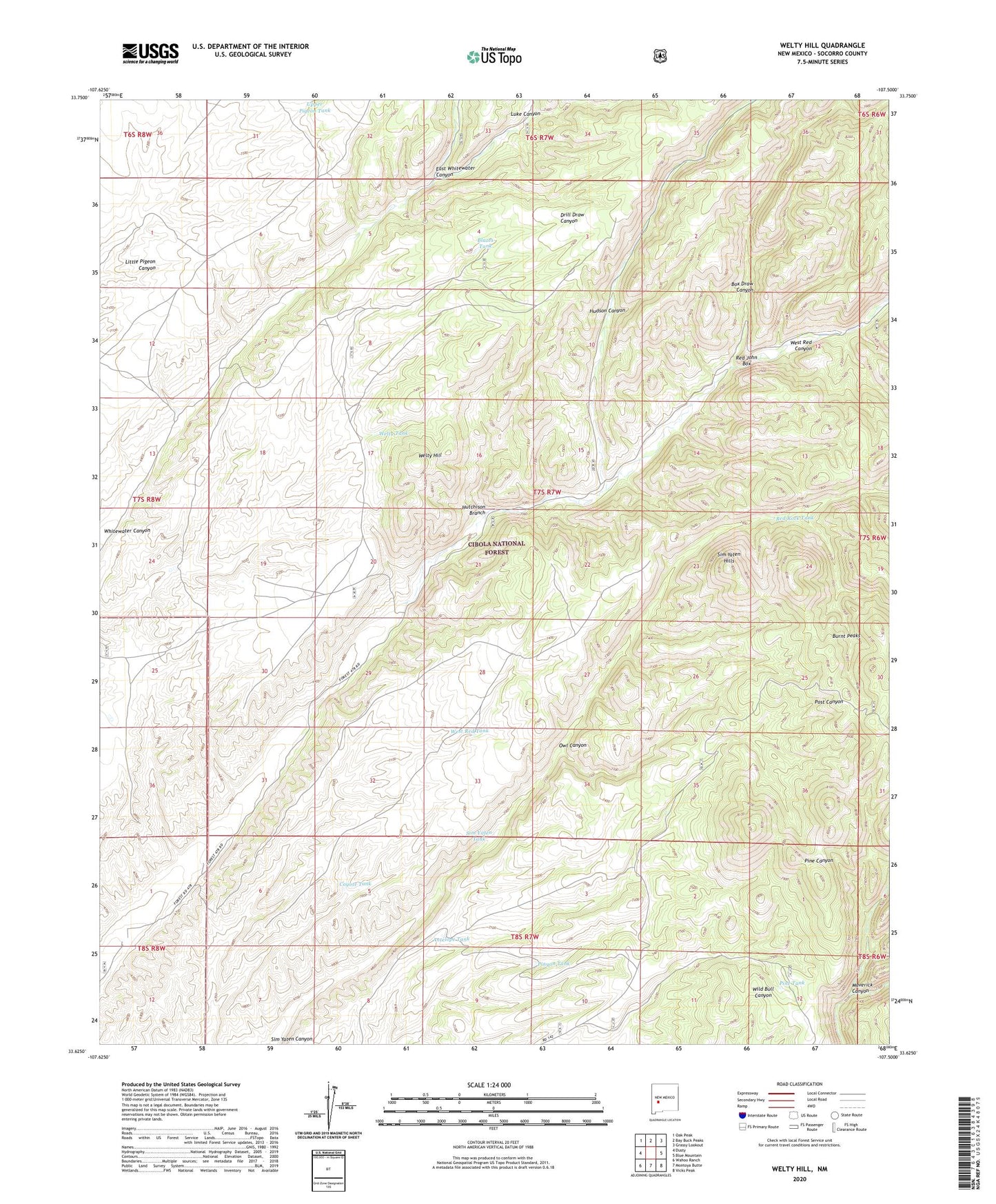
Welty Hill New Mexico US Topo Map
Couldn't load pickup availability
Also explore the Welty Hill Forest Service Topo of this same quad for updated USFS data
2023 topographic map quadrangle Welty Hill in the state of New Mexico. Scale: 1:24000. Based on the newly updated USGS 7.5' US Topo map series, this map is in the following counties: Socorro. The map contains contour data, water features, and other items you are used to seeing on USGS maps, but also has updated roads and other features. This is the next generation of topographic maps. Printed on high-quality waterproof paper with UV fade-resistant inks.
Quads adjacent to this one:
West: Dusty
Northwest: Oak Peak
North: Bay Buck Peaks
Northeast: Grassy Lookout
East: Blue Mountain
Southeast: Vicks Peak
South: Montoya Butte
Southwest: Wahoo Ranch
This map covers the same area as the classic USGS quad with code o33107f5.
Contains the following named places: Antelope Tank, Blazes Tank, Box Draw Canyon, Burnt Peaks, Coyote Tank, East Whitewater Canyon, Eds Place, Hudson Canyon, Hutchison Branch, Luke Canyon, Maverick Canyon, Owl Canyon, Pine Cabin, Pine Tank, Pinyon Corral, Pinyon Tank, Red John Box, Red John Well, Red Rock Tank, Rock Spring Tank, Sim Yaten Hills, Sim Yaten Tank, Upper Pigeon Tank, Welty Hill, Welty Tank, West Red Tank