MyTopo
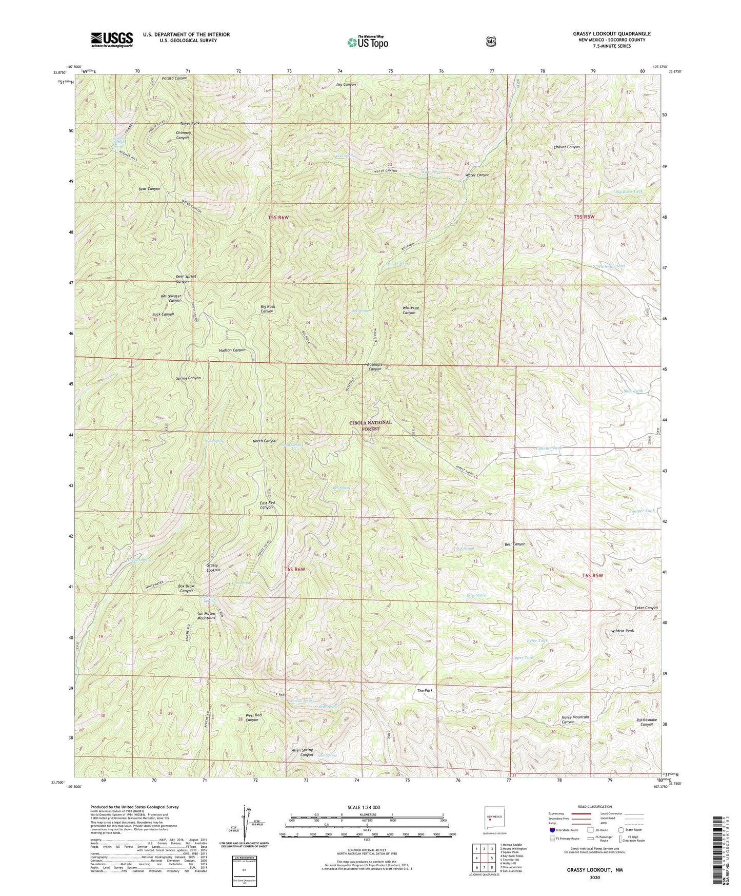
Grassy Lookout New Mexico US Topo Map
Couldn't load pickup availability
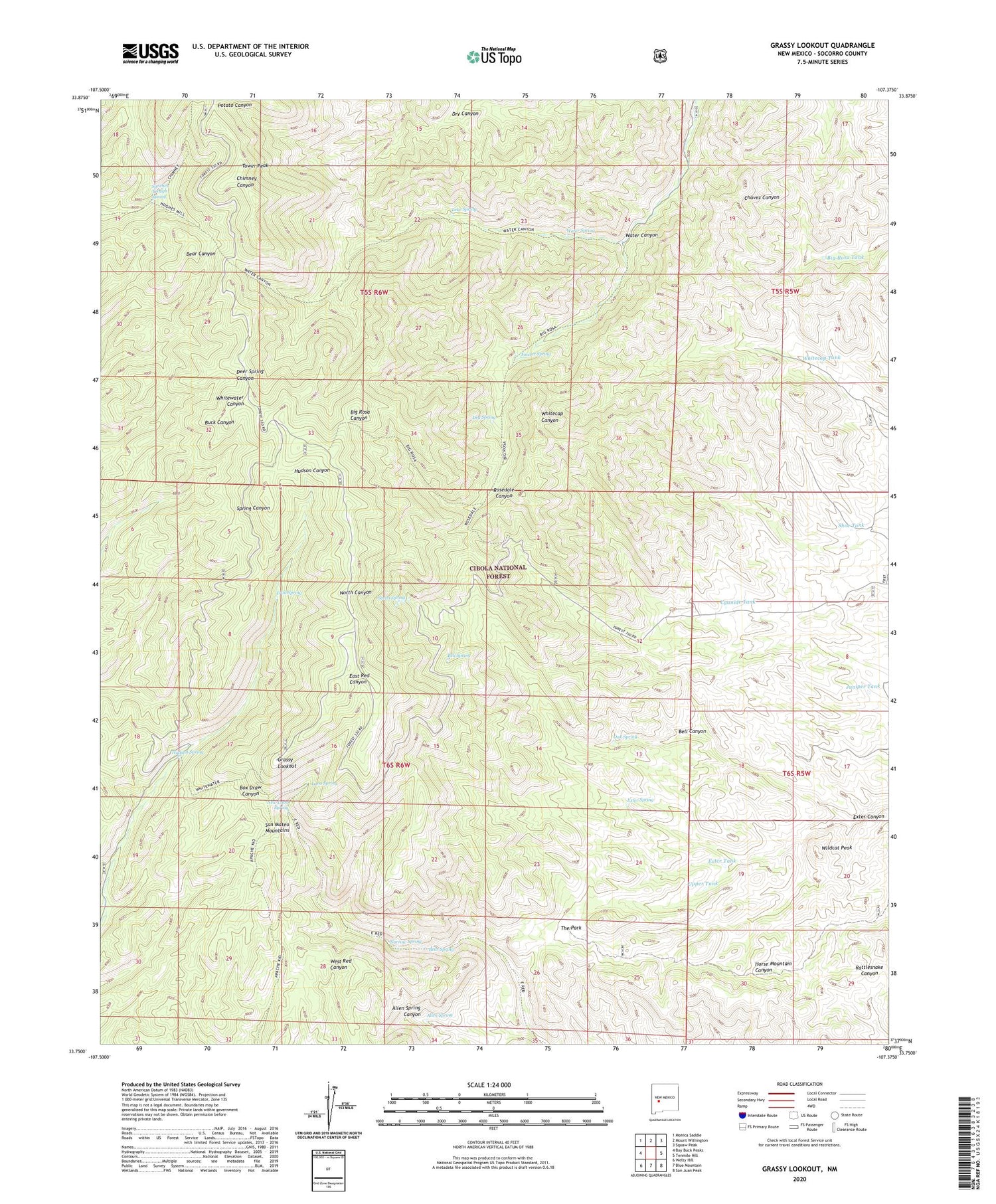
Also explore the Grassy Lookout Forest Service Topo of this same quad for updated USFS data
2023 topographic map quadrangle Grassy Lookout in the state of New Mexico. Scale: 1:24000. Based on the newly updated USGS 7.5' US Topo map series, this map is in the following counties: Socorro. The map contains contour data, water features, and other items you are used to seeing on USGS maps, but also has updated roads and other features. This is the next generation of topographic maps. Printed on high-quality waterproof paper with UV fade-resistant inks.
Quads adjacent to this one:
West: Bay Buck Peaks
Northwest: Monica Saddle
North: Mount Withington
Northeast: Squaw Peak
East: Tenmile Hill
Southeast: San Juan Peak
South: Blue Mountain
Southwest: Welty Hill
This map covers the same area as the classic USGS quad with code o33107g4.
Contains the following named places: Allen Spring, Bear Spring, Bell Canyon, Bell Mine, Bell Spring, Big Rosa Tank, Cyanide Tank, Dry Spring, Exter Canyon, Exter Spring, Exter Tank, Fowler Spring, Grassy Lookout, Hudson Spring, Juniper Tank, Lane Prospect, Lava Spring, Leke Spring, Narrow Spring, New Golden Bell Mine, New Lava Spring, Oak Spring, Park Well, Robb Prospect, Rosedale, Rosedale Cemetery, Rosedale Mine, Sanchez Trough Spring, Seven Spring, Shoe Tank, The Park, Tower Peak, Trail Spring, Upper Tank, Water Canyon, Water Spring, Whitecap Tank, Wildcat Peak