MyTopo
Amenia New York US Topo Map
Couldn't load pickup availability
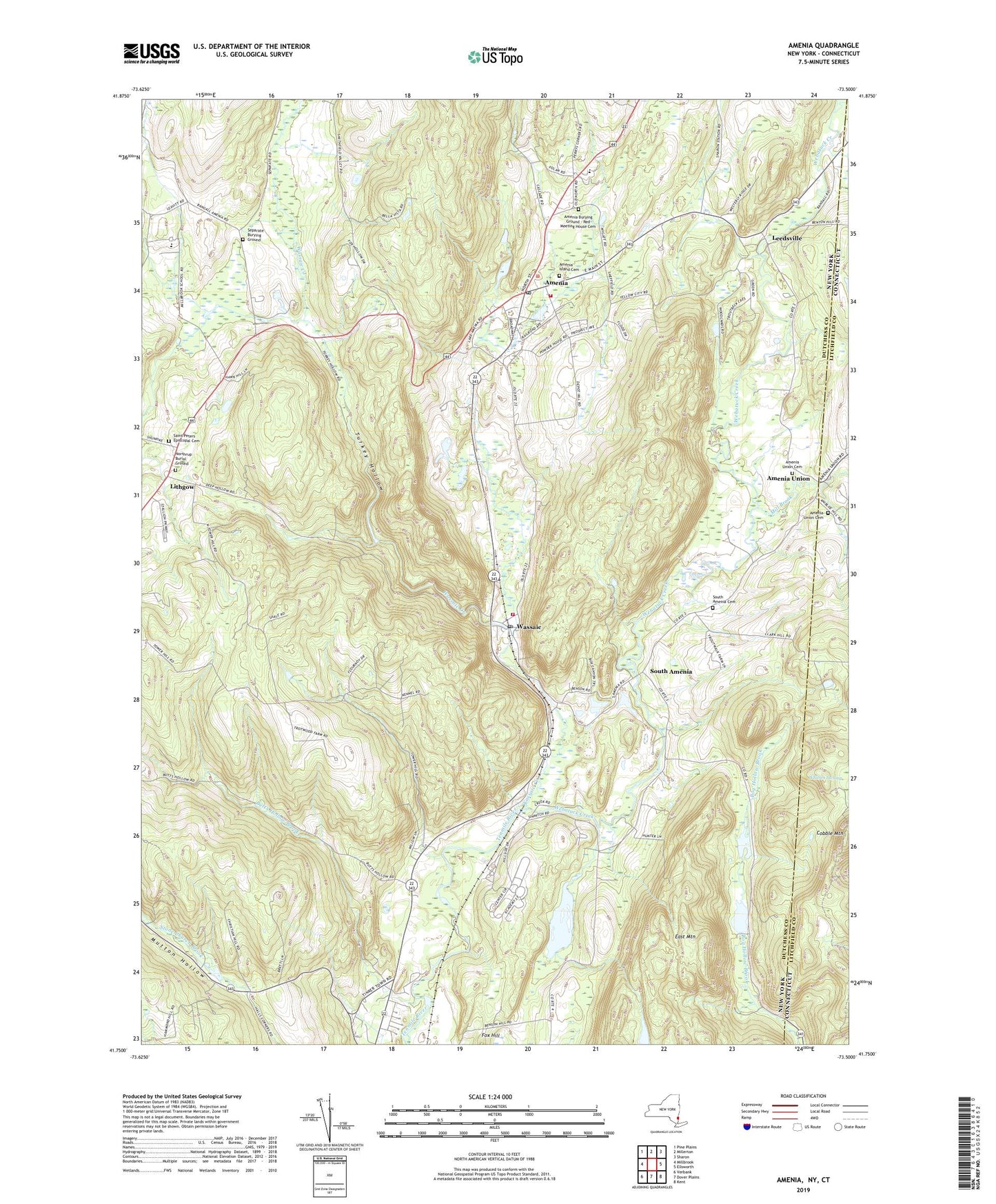
2023 topographic map quadrangle Amenia in the states of New York, Connecticut. Scale: 1:24000. Based on the newly updated USGS 7.5' US Topo map series, this map is in the following counties: Dutchess, Litchfield. The map contains contour data, water features, and other items you are used to seeing on USGS maps, but also has updated roads and other features. This is the next generation of topographic maps. Printed on high-quality waterproof paper with UV fade-resistant inks.
Quads adjacent to this one:
West: Millbrook
Northwest: Pine Plains
North: Millerton
Northeast: Sharon
East: Ellsworth
Southeast: Kent
South: Dover Plains
Southwest: Verbank
This map covers the same area as the classic USGS quad with code o41073g5.
Contains the following named places: Amenia, Amenia Burying Ground - Red Meeting House Cemetery, Amenia Census Designated Place, Amenia Drive-In, Amenia Elementary School, Amenia Fire Company, Amenia Free Library, Amenia Island Cemetery, Amenia Post Office, Amenia Town Hall, Amenia Union, Amenia Union Cemetery, Bell School, Butts Hollow Brook, Castle Gate Mobile Home Park, Cobble Mountain, Evergreen Farm, Immaculate Conception Church, Indian Lake Creek, Leedsville, Lithgow, Maplebrook School, Mill Brook, Millbrook School, Mutton Hollow, Northrup Burial Ground, Oak Leaf Hill Farm, Saint Peters Church, Saint Peters Episcopal Cemetery, Saint Thomas Episcopal Church, Separate Burying Ground, Silo Ridge Country Club, South Amenia, South Amenia Cemetery, Stone Church Brook, Swift Pond, Tenmile River Station, Town of Amenia, Turkey Hollow, United Presbyterian Church, Wassaic, Wassaic Census Designated Place, Wassaic Creek, Wassaic Post Office, Wassaic State Multiple Use Area, Wassaic State School, Wassaic Station, Wassaic Volunteer Fire Company, Webatuck Creek, ZIP Codes: 12501, 12592