MyTopo
Natural Dam New York US Topo Map
Couldn't load pickup availability
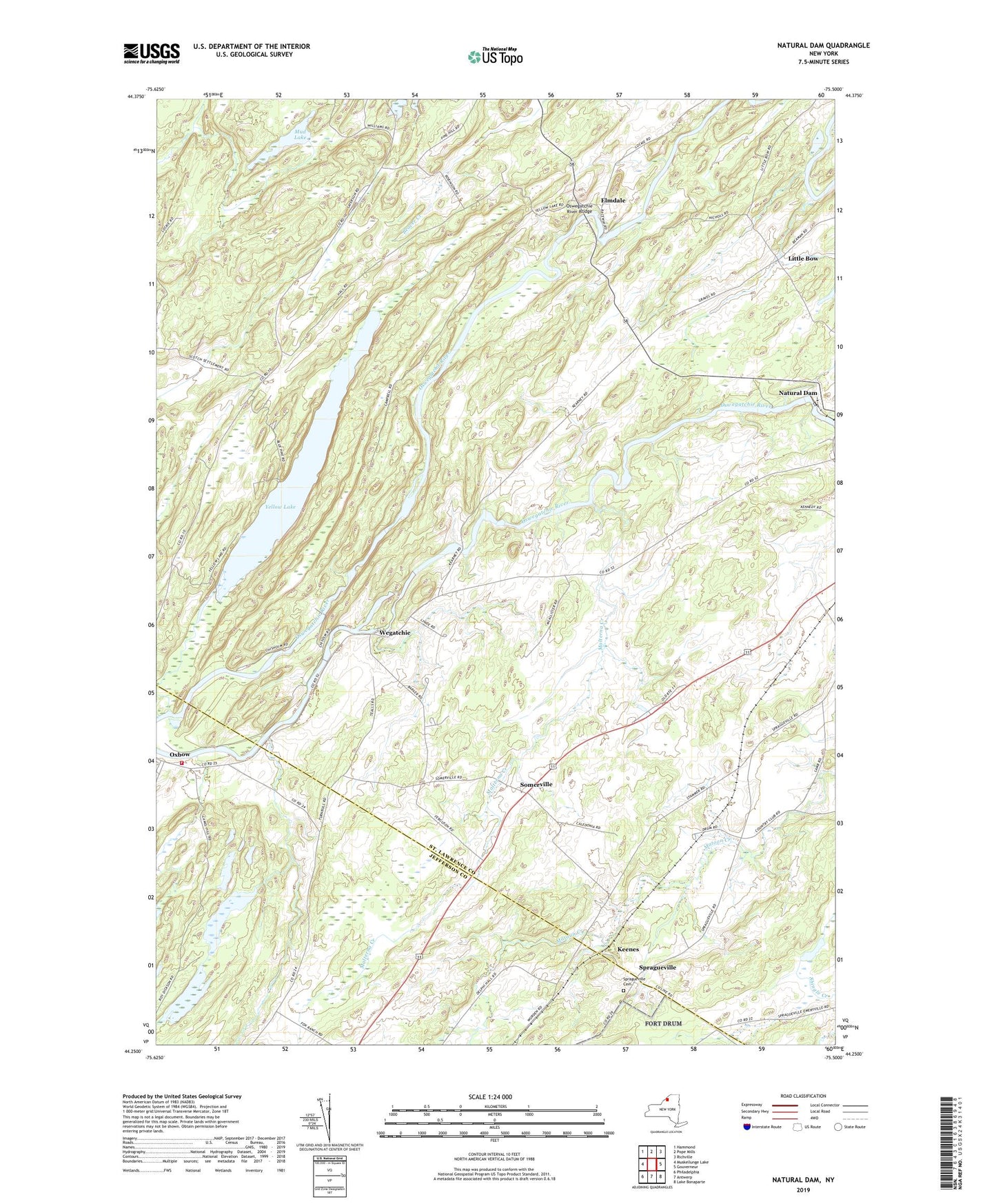
2023 topographic map quadrangle Natural Dam in the state of New York. Scale: 1:24000. Based on the newly updated USGS 7.5' US Topo map series, this map is in the following counties: St. Lawrence, Jefferson. The map contains contour data, water features, and other items you are used to seeing on USGS maps, but also has updated roads and other features. This is the next generation of topographic maps. Printed on high-quality waterproof paper with UV fade-resistant inks.
Quads adjacent to this one:
West: Muskellunge Lake
Northwest: Hammond
North: Pope Mills
Northeast: Richville
East: Gouverneur
Southeast: Lake Bonaparte
South: Antwerp
Southwest: Philadelphia
This map covers the same area as the classic USGS quad with code o44075c5.
Contains the following named places: Elmdale, Keenes, Laidlow School, Little Bow, Malterna Creek, Mud Lake, Natural Dam, Oswegatchie River Bridge, Oxbow, Oxbow Volunteer Fire Department, Pikes Corner, School Number 12, School Number 2, Scotch Settlement School, Somerville, Spragueville, Spragueville Cemetery, Vrooman Creek, Wegatchie, Wilhome Dairy Farms, Yellow Lake, ZIP Code: 13608