MyTopo
Au Sable Forks New York US Topo Map
Couldn't load pickup availability
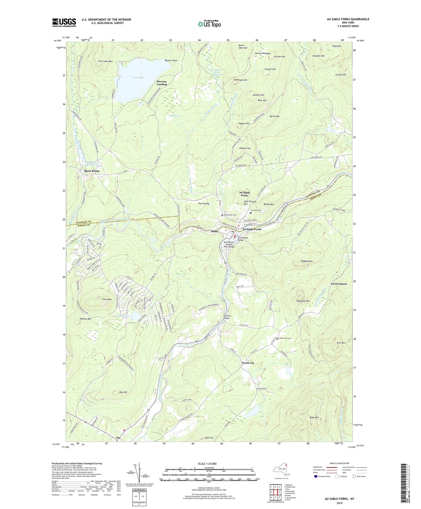
2019 topographic map quadrangle Au Sable Forks in the state of New York. Scale: 1:24000. Based on the newly updated USGS 7.5' US Topo map series, this map is in the following counties: Essex, Clinton. The map contains contour data, water features, and other items you are used to seeing on USGS maps, but also has updated roads and other features. This is the next generation of topographic maps. Printed on high-quality waterproof paper with UV fade-resistant inks.
Quads adjacent to this one:
West: Wilmington
Northwest: Redford
North: Peasleeville
Northeast: Peru
East: Clintonville
Southeast: Lewis
South: Jay Mountain
Southwest: Keene
Contains the following named places: Arnold Hill, Asgaard Farm, Au Sable Central Rural School, Au Sable Forks, Au Sable Forks Census Designated Place, Au Sable Forks Elementary School, Au Sable Forks Post Office, Au Sable Forks Vol. Fire Dept., Au Sable Forks Volunteer Ambulance Service, Ausable Forks Primary School, Bailey Mountain, Bear Hill, Bear Swamp, Beaver Point, Black Brook, Black Brook Pond, Burnt Hill, Burnt Spot Hill, Carrow Hill, Carrow Meadow, Church of the Holy Name, Clark Mountain, Daby Mountain, Drag Mountain, East Branch Ausable River, East Branch AuSable River Bridge, Ellis Mountain, Fairview Cemetery, Fern Lake, Fern Lake Mountain, First Methodist Church, French Hill, Golf Ground Hill, Green Street, Grove Road Bridge, Hamlin Mountain, Haystack Mountain, Holy Name Cemetery, Holy Name Church, Holy Name School, Jackson Brook, Jay, Jay Volunteer Fire Department, Lake Eaton, Lamora Hill, North Jay, North Jay Cemetery, Oak Hill, Palmer Brook, Palmer Brook Swamp, Palmer Hill, Pigeon Hill, Ragged Mountain, Rome, Saint James Episcopal Church, Saint Matthew's Church, Stevens Landing, Stickney Bridge, Tamarack Hill, The Grove, The Swamp, West Branch Ausable River