MyTopo
Redford New York US Topo Map
Couldn't load pickup availability
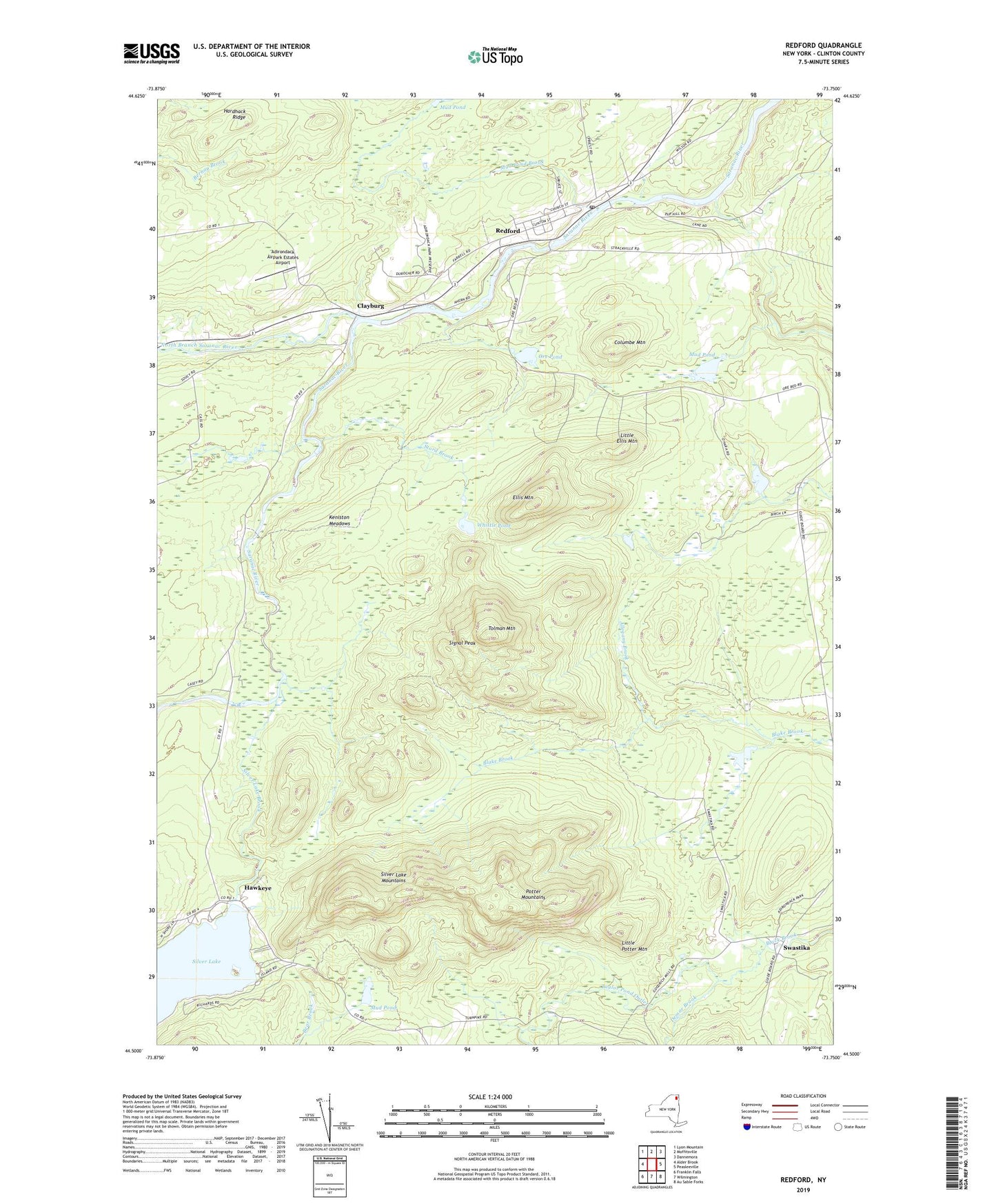
2023 topographic map quadrangle Redford in the state of New York. Scale: 1:24000. Based on the newly updated USGS 7.5' US Topo map series, this map is in the following counties: Clinton. The map contains contour data, water features, and other items you are used to seeing on USGS maps, but also has updated roads and other features. This is the next generation of topographic maps. Printed on high-quality waterproof paper with UV fade-resistant inks.
Quads adjacent to this one:
West: Alder Brook
Northwest: Lyon Mountain
North: Moffitsville
Northeast: Dannemora
East: Peasleeville
Southeast: Au Sable Forks
South: Wilmington
Southwest: Franklin Falls
This map covers the same area as the classic USGS quad with code o44073e7.
Contains the following named places: Adirondack Airpark Estates Airport, Allegany Brook, Assumption of Mary Church, Assumption of Mary School, Clayburg, Columbe Mountain, Demar Brook, Ellis Mountain, Hardhack Ridge, Hawkeye, Keniston Meadows, Little Ellis Mountain, Little Potter Mountain, Mud Pond, Mud Pond Brook, North Branch Saranac River, Ore Pond, Potter Mountains, Redford, Redford Census Designated Place, Redford Post Office, Signal Peak, Silver Lake Brook, Silver Lake Mountain Trail, Silver Lake Mountains, Stord Brook, Swastika, Taylor Pond Outlet, Tefft Pond, Tolman Mountain, Town of Black Brook, Whistle Pond, ZIP Code: 12978