MyTopo
Allentown New York US Topo Map
Couldn't load pickup availability
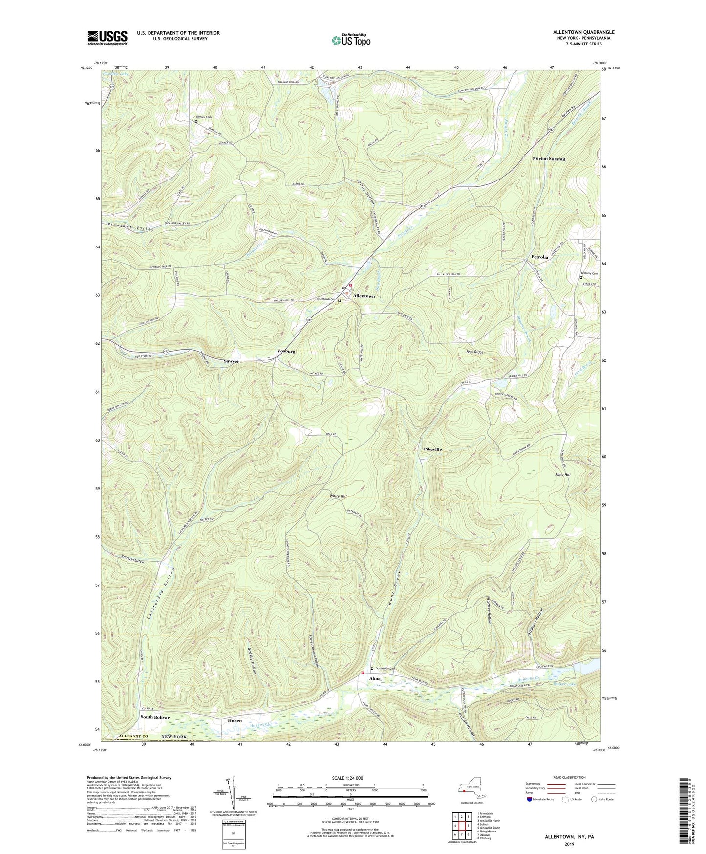
2023 topographic map quadrangle Allentown in the state of New York. Scale: 1:24000. Based on the newly updated USGS 7.5' US Topo map series, this map is in the following counties: Allegany, Potter. The map contains contour data, water features, and other items you are used to seeing on USGS maps, but also has updated roads and other features. This is the next generation of topographic maps. Printed on high-quality waterproof paper with UV fade-resistant inks.
Quads adjacent to this one:
West: Bolivar
Northwest: Friendship
North: Belmont
Northeast: Wellsville North
East: Wellsville South
Southeast: Ellisburg
South: Oswayo
Southwest: Shinglehouse
Contains the following named places: Allentown, Allentown Cemetery, Allentown Post Office, Allentown Volunteer Fire Department, Alma, Alma Fire Department, Alma Hill, Babcock School, Beaver Lake, Bellamy Cemetery, Bow Ridge, Bradford Hollow, Breezy Point Campground, California Hollow, Dimick Cemetery, Dimmick School, Dutton Hollow, Fiftythree Hollow, Gadsby Hollow, Hoben, Hog Brook, Hunt Creek, Kansas Hollow, Norton School, Norton Summit, Petrolia, Phillips Hill School, Pikeville, Pleasant Valley School, Sawyer, School Number 5, South Bolivar, Spring Hollow, Stony Lonesome Hollow, Sunnyside Cemetery, Town of Alma, Vosburg, White Hill, White Hill School, ZIP Codes: 14707, 14708